

1b Scheer Ulm
A cycling route starting in Scheer, Baden-Wurttemberg, Germany.
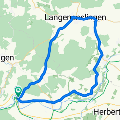
Overview
About this route
Danube Cycle Path
- -:--
- Duration
- 97.2 km
- Distance
- 136 m
- Ascent
- 229 m
- Descent
- ---
- Avg. speed
- ---
- Max. altitude

Route quality
Waytypes & surfaces along the route
Waytypes
Track
44.7 km
(46 %)
Quiet road
19.4 km
(20 %)
Surfaces
Paved
81.7 km
(84 %)
Unpaved
6.8 km
(7 %)
Asphalt
80.7 km
(83 %)
Loose gravel
4.9 km
(5 %)
Route highlights
Points of interest along the route

Photo after 39.6 km
Rechtenstein

Photo after 96.3 km
Widok z Katedry w Ulm
Continue with Bikemap
Use, edit, or download this cycling route
You would like to ride 1b Scheer Ulm or customize it for your own trip? Here is what you can do with this Bikemap route:
Free features
- Save this route as favorite or in collections
- Copy & plan your own version of this route
- Split it into stages to create a multi-day tour
- Sync your route with Garmin or Wahoo
Premium features
Free trial for 3 days, or one-time payment. More about Bikemap Premium.
- Navigate this route on iOS & Android
- Export a GPX / KML file of this route
- Create your custom printout (try it for free)
- Download this route for offline navigation
Discover more Premium features.
Get Bikemap PremiumFrom our community
Other popular routes starting in Scheer
 ölkofen
- Distance
- 12.5 km
- Ascent
- 141 m
- Descent
- 168 m
- Location
- Scheer, Baden-Wurttemberg, Germany
 Ertingen
- Distance
- 35.2 km
- Ascent
- 238 m
- Descent
- 250 m
- Location
- Scheer, Baden-Wurttemberg, Germany
 4. Tag Scheer - tuttlingen
- Distance
- 66.7 km
- Ascent
- 259 m
- Descent
- 174 m
- Location
- Scheer, Baden-Wurttemberg, Germany
 geschäft
- Distance
- 11.1 km
- Ascent
- 254 m
- Descent
- 256 m
- Location
- Scheer, Baden-Wurttemberg, Germany
 30km Sigmaringendorf Donau
- Distance
- 30.5 km
- Ascent
- 280 m
- Descent
- 262 m
- Location
- Scheer, Baden-Wurttemberg, Germany
 Scheer 33,3-530m
- Distance
- 33.3 km
- Ascent
- 607 m
- Descent
- 606 m
- Location
- Scheer, Baden-Wurttemberg, Germany
 Donautal, rauf und runter
- Distance
- 124.1 km
- Ascent
- 2,051 m
- Descent
- 2,013 m
- Location
- Scheer, Baden-Wurttemberg, Germany
 2014 Donauradweg 03 Scheer - Ehingen
- Distance
- 64.8 km
- Ascent
- 154 m
- Descent
- 216 m
- Location
- Scheer, Baden-Wurttemberg, Germany
Open it in the app