

Do Tankovej
A cycling route starting in Ľubica, Prešov Region, Slovakia.
Overview
About this route
1.4.2017
- 34 min
- Duration
- 5.7 km
- Distance
- 83 m
- Ascent
- 17 m
- Descent
- 10.1 km/h
- Avg. speed
- ---
- Max. altitude
Route quality
Waytypes & surfaces along the route
Waytypes
Quiet road
5.4 km
(94 %)
Road
0.3 km
(5 %)
Access road
0.1 km
(1 %)
Surfaces
Paved
1.4 km
(24 %)
Concrete
1.3 km
(22 %)
Asphalt
0.1 km
(2 %)
Undefined
4.3 km
(76 %)
Route highlights
Points of interest along the route
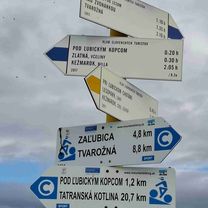
Point of interest after 5.6 km
Tanková

Photo after 5.6 km
Zchátrané budovy v bývalom tankodrome
Continue with Bikemap
Use, edit, or download this cycling route
You would like to ride Do Tankovej or customize it for your own trip? Here is what you can do with this Bikemap route:
Free features
- Save this route as favorite or in collections
- Copy & plan your own version of this route
- Sync your route with Garmin or Wahoo
Premium features
Free trial for 3 days, or one-time payment. More about Bikemap Premium.
- Navigate this route on iOS & Android
- Export a GPX / KML file of this route
- Create your custom printout (try it for free)
- Download this route for offline navigation
Discover more Premium features.
Get Bikemap PremiumFrom our community
Other popular routes starting in Ľubica
 KK - SL v1
- Distance
- 43.8 km
- Ascent
- 638 m
- Descent
- 752 m
- Location
- Ľubica, Prešov Region, Slovakia
 981 Levocke Vrhy 23.09.2010
- Distance
- 101.7 km
- Ascent
- 1,480 m
- Descent
- 1,480 m
- Location
- Ľubica, Prešov Region, Slovakia
 KK - SL v2
- Distance
- 37.6 km
- Ascent
- 534 m
- Descent
- 650 m
- Location
- Ľubica, Prešov Region, Slovakia
 Ľubica- Ľubica, Pod lesom- Kotenhag- chata Vinná
- Distance
- 19.2 km
- Ascent
- 614 m
- Descent
- 33 m
- Location
- Ľubica, Prešov Region, Slovakia
 Kežmarok, Levoča
- Distance
- 62.9 km
- Ascent
- 992 m
- Descent
- 998 m
- Location
- Ľubica, Prešov Region, Slovakia
 Levocske_vrchy_Marculina
- Distance
- 42.8 km
- Ascent
- 786 m
- Descent
- 797 m
- Location
- Ľubica, Prešov Region, Slovakia
 sobota
- Distance
- 19.9 km
- Ascent
- 265 m
- Descent
- 427 m
- Location
- Ľubica, Prešov Region, Slovakia
 Ku ruskému táboru
- Distance
- 10.1 km
- Ascent
- 83 m
- Descent
- 141 m
- Location
- Ľubica, Prešov Region, Slovakia
Open it in the app