

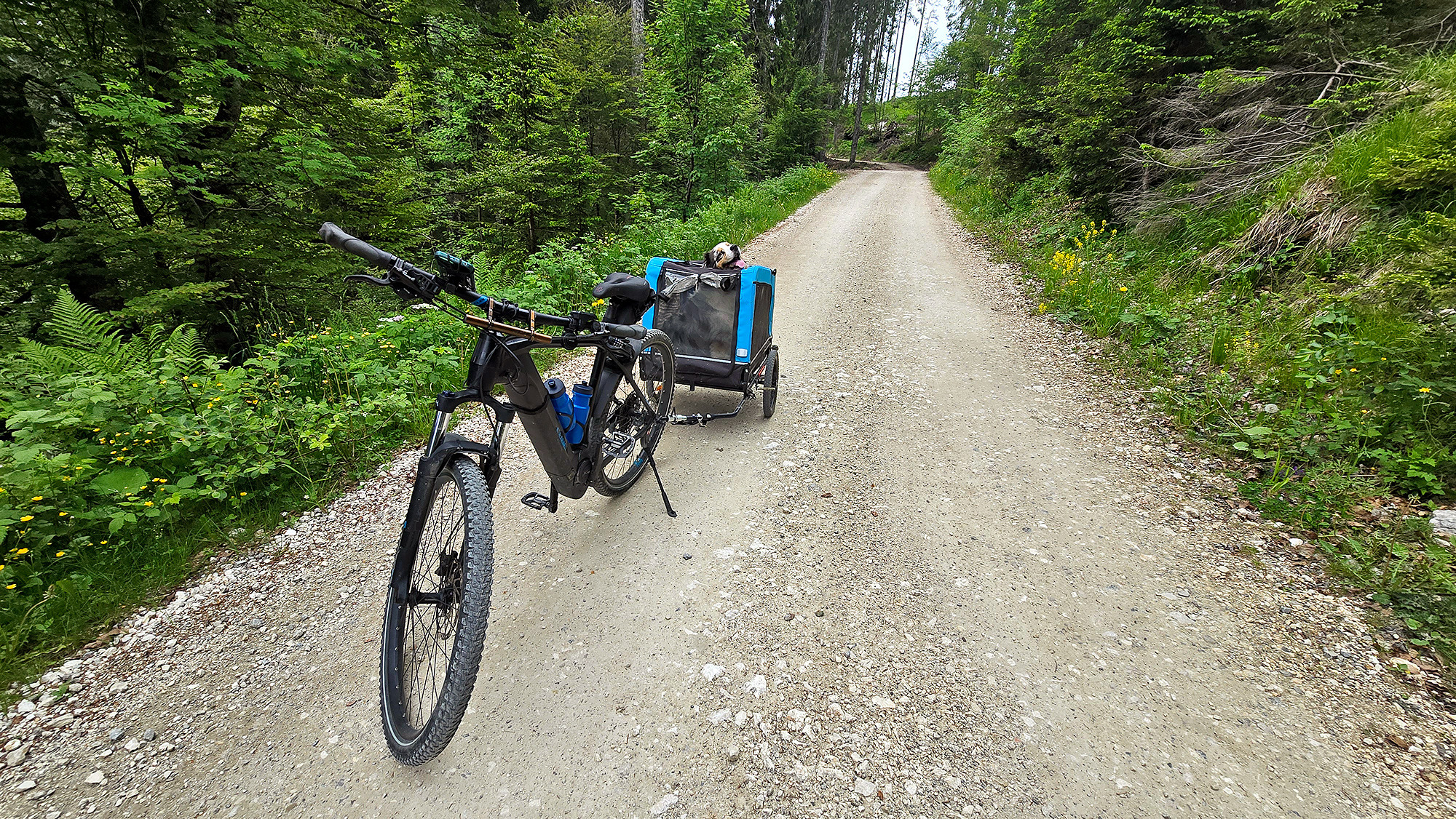
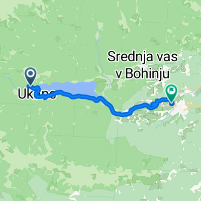
Rudno polje čez Podjelje - Gorelek
A cycling route starting in Bohinjska Bistrica, Bohinj Municipality, Slovenia.
Overview
About this route
- -:--
- Duration
- 46.6 km
- Distance
- 881 m
- Ascent
- 880 m
- Descent
- ---
- Avg. speed
- ---
- Max. altitude

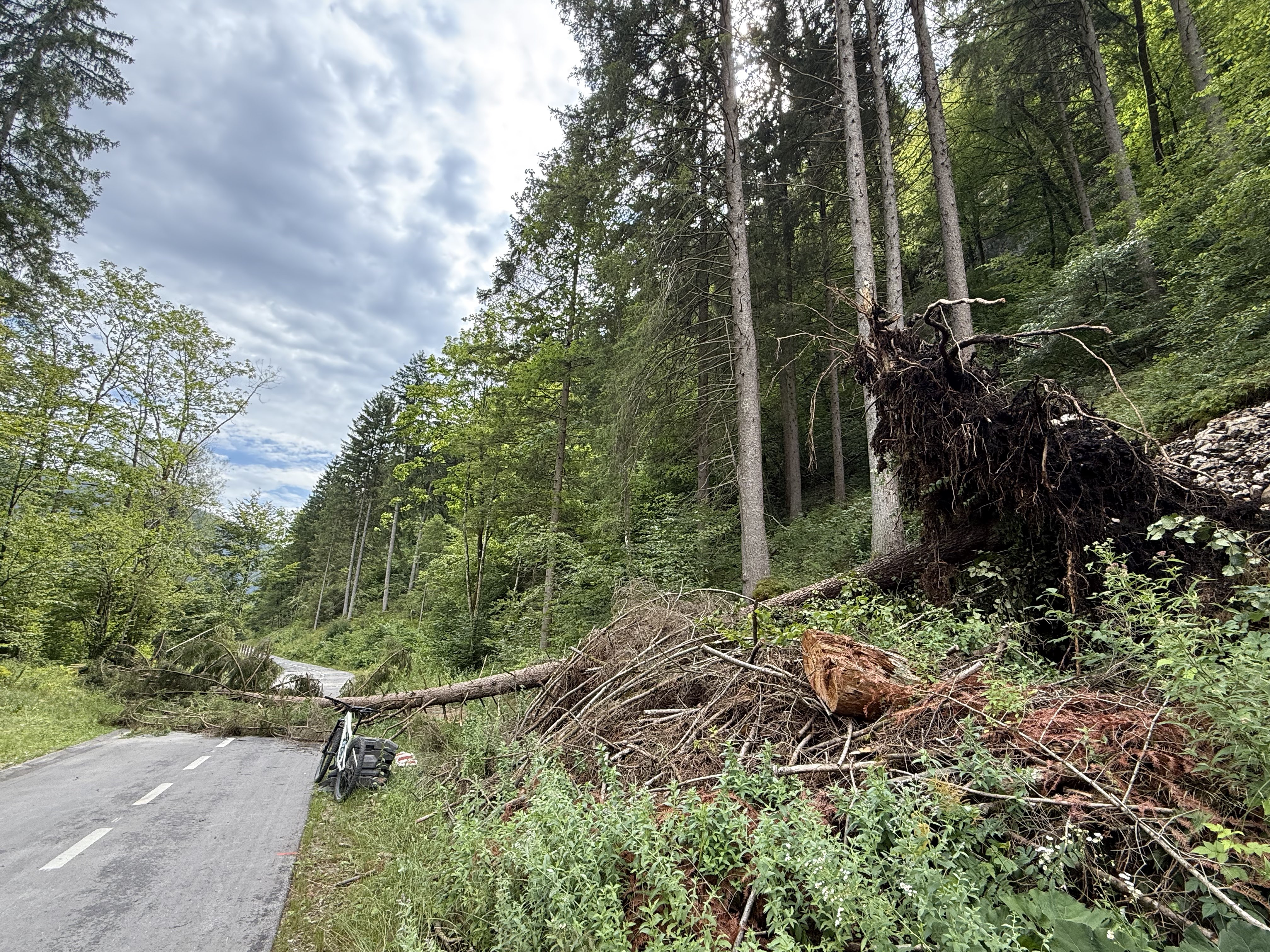
Route photos


Continue with Bikemap
Use, edit, or download this cycling route
You would like to ride Rudno polje čez Podjelje - Gorelek or customize it for your own trip? Here is what you can do with this Bikemap route:
Free features
- Save this route as favorite or in collections
- Copy & plan your own version of this route
- Sync your route with Garmin or Wahoo
Premium features
Free trial for 3 days, or one-time payment. More about Bikemap Premium.
- Navigate this route on iOS & Android
- Export a GPX / KML file of this route
- Create your custom printout (try it for free)
- Download this route for offline navigation
Discover more Premium features.
Get Bikemap PremiumFrom our community
Other popular routes starting in Bohinjska Bistrica
 BOHINJ-SAVICA-OKOLI JEZERA
- Distance
- 35 km
- Ascent
- 472 m
- Descent
- 483 m
- Location
- Bohinjska Bistrica, Bohinj Municipality, Slovenia
 Letoviška ulica, Bohinjska Bistrica do Ribčev Laz, Bohinjsko Jezero
- Distance
- 8.3 km
- Ascent
- 73 m
- Descent
- 67 m
- Location
- Bohinjska Bistrica, Bohinj Municipality, Slovenia
 Komenda
- Distance
- 113.1 km
- Ascent
- 2,862 m
- Descent
- 2,862 m
- Location
- Bohinjska Bistrica, Bohinj Municipality, Slovenia
 Pokljuka MTB
- Distance
- 22.9 km
- Ascent
- 832 m
- Descent
- 835 m
- Location
- Bohinjska Bistrica, Bohinj Municipality, Slovenia
 Da Bohinjska Bistrica a Čeplez
- Distance
- 40 km
- Ascent
- 2,015 m
- Descent
- 2,200 m
- Location
- Bohinjska Bistrica, Bohinj Municipality, Slovenia
 Triglavska cesta, Bohinjska Bistrica - Regionalna Cesta 904, Bohinjsko Jezero
- Distance
- 7 km
- Ascent
- 58 m
- Descent
- 40 m
- Location
- Bohinjska Bistrica, Bohinj Municipality, Slovenia
 Ukanc, Bohinjsko Jezero to Triglavska cesta, Bohinjska Bistrica
- Distance
- 13.9 km
- Ascent
- 66 m
- Descent
- 95 m
- Location
- Bohinjska Bistrica, Bohinj Municipality, Slovenia
 Snail-like route in Bohinjska Bistrica
- Distance
- 20.1 km
- Ascent
- 146 m
- Descent
- 155 m
- Location
- Bohinjska Bistrica, Bohinj Municipality, Slovenia
Open it in the app