

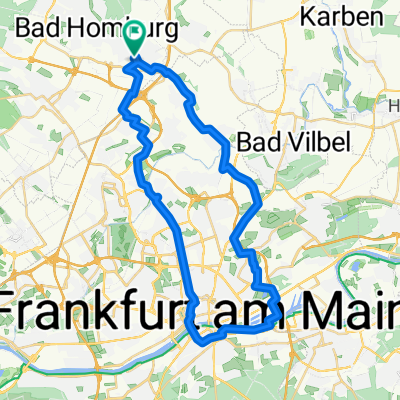
Steinkopf über Lochmühle
A cycling route starting in Bad Homburg, Hesse, Germany.
Overview
About this route
NiEs-LoMü-WiSt-StKo-KuKo-NiEs
Nieder-Eschbach
Lochmühle
Winterstein
Steinkopf
Kuhkopf
- -:--
- Duration
- 44.7 km
- Distance
- 590 m
- Ascent
- 593 m
- Descent
- ---
- Avg. speed
- ---
- Max. altitude

Route quality
Waytypes & surfaces along the route
Waytypes
Track
29 km
(65 %)
Quiet road
8.5 km
(19 %)
Surfaces
Paved
20.4 km
(46 %)
Unpaved
23.7 km
(53 %)
Asphalt
20.3 km
(45 %)
Gravel
14.3 km
(32 %)
Route highlights
Points of interest along the route
Point of interest after 14.2 km
Lochmühle
Point of interest after 24.8 km
Winterstein
Point of interest after 26.1 km
Steinkopf
Point of interest after 27.7 km
Kuhkopf
Continue with Bikemap
Use, edit, or download this cycling route
You would like to ride Steinkopf über Lochmühle or customize it for your own trip? Here is what you can do with this Bikemap route:
Free features
- Save this route as favorite or in collections
- Copy & plan your own version of this route
- Sync your route with Garmin or Wahoo
Premium features
Free trial for 3 days, or one-time payment. More about Bikemap Premium.
- Navigate this route on iOS & Android
- Export a GPX / KML file of this route
- Create your custom printout (try it for free)
- Download this route for offline navigation
Discover more Premium features.
Get Bikemap PremiumFrom our community
Other popular routes starting in Bad Homburg
 Rechts der Saalburg
- Distance
- 14 km
- Ascent
- 298 m
- Descent
- 296 m
- Location
- Bad Homburg, Hesse, Germany
 HG-Schwedlersee
- Distance
- 34.7 km
- Ascent
- 212 m
- Descent
- 215 m
- Location
- Bad Homburg, Hesse, Germany
 Steinkopf über Lochmühle
- Distance
- 44.7 km
- Ascent
- 590 m
- Descent
- 593 m
- Location
- Bad Homburg, Hesse, Germany
 RR 069 Wetterau, Södel
- Distance
- 68.9 km
- Ascent
- 232 m
- Descent
- 240 m
- Location
- Bad Homburg, Hesse, Germany
 BH - Rund um Frankfurt
- Distance
- 121.3 km
- Ascent
- 323 m
- Descent
- 325 m
- Location
- Bad Homburg, Hesse, Germany
 Bad Homburg-Seulberg-Saalburg
- Distance
- 24.3 km
- Ascent
- 336 m
- Descent
- 333 m
- Location
- Bad Homburg, Hesse, Germany
 von Frigo-Home nach Sachsenhausen (Äppelwoi-Lokal "Feuerrädchen) und Rückfahrt über Gerbermühle
- Distance
- 38.3 km
- Ascent
- 181 m
- Descent
- 181 m
- Location
- Bad Homburg, Hesse, Germany
 Feldbergrunde (Taunus)
- Distance
- 64.6 km
- Ascent
- 954 m
- Descent
- 954 m
- Location
- Bad Homburg, Hesse, Germany
Open it in the app