


Über den Cobenzl in den nördlichen Wienerwald
A cycling route starting in Deutsch-Wagram, Lower Austria, Austria.
Overview
About this route
5
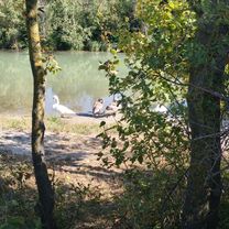
Schöner Radausflug auf den Cobenzl und über den nördlichen Wienerwald an die Donau und zurück ins Marchfeld
- -:--
- Duration
- 92.4 km
- Distance
- 476 m
- Ascent
- 476 m
- Descent
- ---
- Avg. speed
- ---
- Max. altitude
Gerold B
created this 9 years ago
Route quality
Waytypes & surfaces along the route
Waytypes
Cycleway
21.2 km
23 %
Track
20.3 km
22 %
Surfaces
Paved
58.2 km
(63 %)
Unpaved
26.8 km
(29 %)
Asphalt
57.3 km
62 %
Loose gravel
13.9 km
15 %
Continue with Bikemap
Use, edit, or download this cycling route
You would like to ride Über den Cobenzl in den nördlichen Wienerwald or customize it for your own trip? Here is what you can do with this Bikemap route:
Free features
- Save this route as favorite or in collections
- Copy & plan your own version of this route
- Split it into stages to create a multi-day tour
- Sync your route with Garmin or Wahoo
Premium features
Free trial for 3 days, or one-time payment. More about Bikemap Premium.
- Navigate this route on iOS & Android
- Export a GPX / KML file of this route
- Create your custom printout (try it for free)
- Download this route for offline navigation
Discover more Premium features.
Get Bikemap PremiumFrom our community
Other popular routes starting in Deutsch-Wagram


 Deutsch-Wagram - Marchfeldkanal - Dampfross Radrunde - Großengersdorf - Deutsch Wagram0
- 39.4 km
- 41 m
- 41 m
- Deutsch-Wagram, Lower Austria, Austria


Open it in the app