- 32.6 km
- 1,248 m
- 1,249 m
- Monticiano, Tuscany, Italy
Villa Ferraia.......San Galgano...Chiusdino
A cycling route starting in Monticiano, Tuscany, Italy.
Overview
About this route
- -:--
- Duration
- 53.2 km
- Distance
- 811 m
- Ascent
- 813 m
- Descent
- ---
- Avg. speed
- ---
- Max. altitude
created this 9 years ago
Route quality
Waytypes & surfaces along the route
Waytypes
Road
10.1 km
19 %
Quiet road
6.9 km
13 %
Surfaces
Paved
22.4 km
(42 %)
Unpaved
6.9 km
(13 %)
Asphalt
22.4 km
42 %
Gravel
4.3 km
8 %
Route highlights
Points of interest along the route

Point of interest after 26.4 km
The municipality of Chiusdino is near Siena and is at an altitude of 564m. The local population is around 2000. HIGHLIGHTS The city is home to San Sebastian Church, Miralduolo Castle, Compagnia di San Galgano Church and the Lenzi stately homes. Before the town existed, the Benedictine Abbey of Santa Maria stood on the same site, built in 1004. The town slowly grew on a nearby hill top ridge and quickly became an important strategic point in the area. The town w
Continue with Bikemap
Use, edit, or download this cycling route
You would like to ride Villa Ferraia.......San Galgano...Chiusdino or customize it for your own trip? Here is what you can do with this Bikemap route:
Free features
- Save this route as favorite or in collections
- Copy & plan your own version of this route
- Sync your route with Garmin or Wahoo
Premium features
Free trial for 3 days, or one-time payment. More about Bikemap Premium.
- Navigate this route on iOS & Android
- Export a GPX / KML file of this route
- Create your custom printout (try it for free)
- Download this route for offline navigation
Discover more Premium features.
Get Bikemap PremiumFrom our community
Other popular routes starting in Monticiano
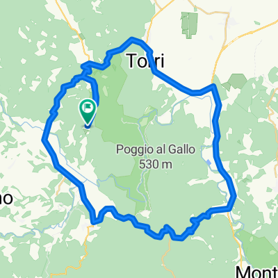
- Strada Vicinale da Frosini a Pentolina, Chiusdino nach Strada Vicinale da Frosini a Pentolina, Chiusdino
- r67km Monticaino
- 66.8 km
- 874 m
- 875 m
- Monticiano, Tuscany, Italy
- pentolina monteriggioni
- 68.2 km
- 580 m
- 585 m
- Monticiano, Tuscany, Italy
- Recovered Route
- 20.6 km
- 733 m
- 701 m
- Monticiano, Tuscany, Italy
- 86km-Monticiano-Fontazzi-Lupompesi-Montreroni-Bagnaia-Rosia-Pntlna
- 86 km
- 1,150 m
- 1,150 m
- Monticiano, Tuscany, Italy
- Pentolina 74, Chiusdino nach Pentolina 118, Chiusdino
- 39.2 km
- 1,098 m
- 1,096 m
- Monticiano, Tuscany, Italy
- Pentolina, Tonni, Sovicille, Rosia, Spannochia, Pentolina
- 31.1 km
- 599 m
- 599 m
- Monticiano, Tuscany, Italy
- Pentolina-kleineHausrunde55km
- 54.8 km
- 653 m
- 653 m
- Monticiano, Tuscany, Italy
Open it in the app


