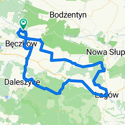
pi膮tek
A cycling route starting in Mas艂贸w, 艢wi臋tokrzyskie Voivodship, Poland.
Overview
About this route
Pi膮tkowy trening 艢wi臋tokrzyskie 2017
- -:--
- Duration
- 53.5 km
- Distance
- 469 m
- Ascent
- 468 m
- Descent
- ---
- Avg. speed
- ---
- Avg. speed
Route quality
Waytypes & surfaces along the route
Waytypes
Road
25.9 km
(48 %)
Quiet road
11.5 km
(22 %)
Surfaces
Paved
47 km
(88 %)
Unpaved
0.4 km
(<1 %)
Asphalt
46.8 km
(88 %)
Unpaved (undefined)
0.4 km
(<1 %)
Continue with Bikemap
Use, edit, or download this cycling route
You would like to ride pi膮tek or customize it for your own trip? Here is what you can do with this Bikemap route:
Free features
- Save this route as favorite or in collections
- Copy & plan your own version of this route
- Sync your route with Garmin or Wahoo
Premium features
Free trial for 3 days, or one-time payment. More about Bikemap Premium.
- Navigate this route on iOS & Android
- Export a GPX / KML file of this route
- Create your custom printout (try it for free)
- Download this route for offline navigation
Discover more Premium features.
Get Bikemap PremiumFrom our community
Other popular routes starting in Mas艂贸w
- g贸r y 艣wi臋tokrzyskie
- Distance
- 47 km
- Ascent
- 808 m
- Descent
- 746 m
- Location
- Mas艂贸w, 艢wi臋tokrzyskie Voivodship, Poland
- niedziela
- Distance
- 118.2 km
- Ascent
- 598 m
- Descent
- 597 m
- Location
- Mas艂贸w, 艢wi臋tokrzyskie Voivodship, Poland
- Z贸艂ty Szlak Rowerowy wok贸艂 Ciekot
- Distance
- 15.1 km
- Ascent
- 208 m
- Descent
- 208 m
- Location
- Mas艂贸w, 艢wi臋tokrzyskie Voivodship, Poland
- 艢wi臋tokrzyska 59, Wola Kopcowa do 艢wi臋tokrzyska 59, Wola Kopcowa
- Distance
- 9.9 km
- Ascent
- 83 m
- Descent
- 100 m
- Location
- Mas艂贸w, 艢wi臋tokrzyskie Voivodship, Poland
- poprzez lasy pola
- Distance
- 16 km
- Ascent
- 233 m
- Descent
- 216 m
- Location
- Mas艂贸w, 艢wi臋tokrzyskie Voivodship, Poland
- szKielecczyzna P贸艂nocna 2 - upa艂 w sosie komarowym
- Distance
- 83 km
- Ascent
- 393 m
- Descent
- 477 m
- Location
- Mas艂贸w, 艢wi臋tokrzyskie Voivodship, Poland
- Rezerwat Barcza
- Distance
- 18.8 km
- Ascent
- 253 m
- Descent
- 254 m
- Location
- Mas艂贸w, 艢wi臋tokrzyskie Voivodship, Poland
- G贸ry 艢wi臋tokrzyskie - I IEtap
- Distance
- 75.7 km
- Ascent
- 615 m
- Descent
- 615 m
- Location
- Mas艂贸w, 艢wi臋tokrzyskie Voivodship, Poland
Open it in the app