

Kyushu trip, Part 2: Oita to Kita-Kyushu
A cycling route starting in Ōita, Oita, Japan.
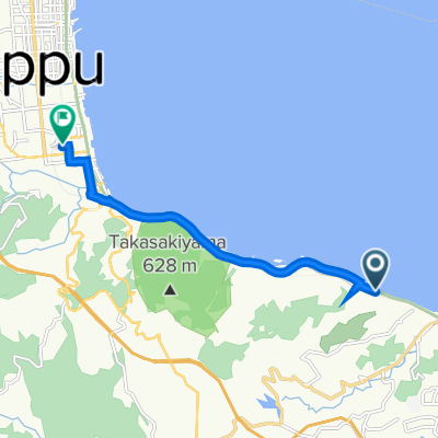
Overview
About this route
- -:--
- Duration
- 175.3 km
- Distance
- 402 m
- Ascent
- 393 m
- Descent
- ---
- Avg. speed
- ---
- Max. altitude
Continue with Bikemap
Use, edit, or download this cycling route
You would like to ride Kyushu trip, Part 2: Oita to Kita-Kyushu or customize it for your own trip? Here is what you can do with this Bikemap route:
Free features
- Save this route as favorite or in collections
- Copy & plan your own version of this route
- Split it into stages to create a multi-day tour
- Sync your route with Garmin or Wahoo
Premium features
Free trial for 3 days, or one-time payment. More about Bikemap Premium.
- Navigate this route on iOS & Android
- Export a GPX / KML file of this route
- Create your custom printout (try it for free)
- Download this route for offline navigation
Discover more Premium features.
Get Bikemap PremiumFrom our community
Other popular routes starting in Ōita
 門前, 大分市 まで門前, 大分市
- Distance
- 17.1 km
- Ascent
- 279 m
- Descent
- 269 m
- Location
- Ōita, Oita, Japan
 大分(Ooita) to 別府(Beppu)
- Distance
- 8 km
- Ascent
- 139 m
- Descent
- 137 m
- Location
- Ōita, Oita, Japan
 戸次本町大野川ルート(戸次エリア)
- Distance
- 9.2 km
- Ascent
- 17 m
- Descent
- 18 m
- Location
- Ōita, Oita, Japan
 oita - yufu
- Distance
- 23.8 km
- Ascent
- 291 m
- Descent
- 133 m
- Location
- Ōita, Oita, Japan
 2-chōme 9, Oita nach 3-chōme 3, Beppu
- Distance
- 34.8 km
- Ascent
- 345 m
- Descent
- 356 m
- Location
- Ōita, Oita, Japan
 大分~佐賀関サイクリング
- Distance
- 72.9 km
- Ascent
- 726 m
- Descent
- 727 m
- Location
- Ōita, Oita, Japan
 2023/03/07コロッケ巡り
- Distance
- 16.1 km
- Ascent
- 100 m
- Descent
- 104 m
- Location
- Ōita, Oita, Japan
 まちなか芸術発見ルート
- Distance
- 4.3 km
- Ascent
- 23 m
- Descent
- 21 m
- Location
- Ōita, Oita, Japan
Open it in the app