

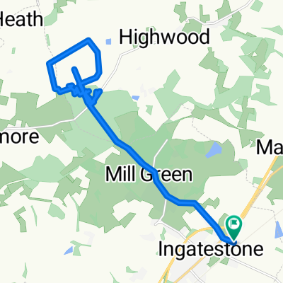
Highwood and Fryerning
A cycling route starting in Ingatestone, England, United Kingdom.
Overview
About this route
- -:--
- Duration
- 17.5 km
- Distance
- 118 m
- Ascent
- 120 m
- Descent
- ---
- Avg. speed
- ---
- Max. altitude

Route quality
Waytypes & surfaces along the route
Waytypes
Road
8.6 km
(49 %)
Quiet road
5.1 km
(29 %)
Surfaces
Paved
3.3 km
(19 %)
Asphalt
3.3 km
(19 %)
Undefined
14.2 km
(81 %)
Continue with Bikemap
Use, edit, or download this cycling route
You would like to ride Highwood and Fryerning or customize it for your own trip? Here is what you can do with this Bikemap route:
Free features
- Save this route as favorite or in collections
- Copy & plan your own version of this route
- Sync your route with Garmin or Wahoo
Premium features
Free trial for 3 days, or one-time payment. More about Bikemap Premium.
- Navigate this route on iOS & Android
- Export a GPX / KML file of this route
- Create your custom printout (try it for free)
- Download this route for offline navigation
Discover more Premium features.
Get Bikemap PremiumFrom our community
Other popular routes starting in Ingatestone
 Highwood and Fryerning
- Distance
- 17.5 km
- Ascent
- 118 m
- Descent
- 120 m
- Location
- Ingatestone, England, United Kingdom
 Clune, Mill Green Road, Ingatestone to 2 High St, Chelmsford
- Distance
- 11.4 km
- Ascent
- 76 m
- Descent
- 133 m
- Location
- Ingatestone, England, United Kingdom
 ride through Ingatestone
- Distance
- 10.2 km
- Ascent
- 47 m
- Descent
- 81 m
- Location
- Ingatestone, England, United Kingdom
 Off Road Ingatestone/Fryning/Blackmore
- Distance
- 17.4 km
- Ascent
- 97 m
- Descent
- 97 m
- Location
- Ingatestone, England, United Kingdom
 Novice
- Distance
- 5.6 km
- Ascent
- 46 m
- Descent
- 45 m
- Location
- Ingatestone, England, United Kingdom
 bike tour through Ingatestone
- Distance
- 20 km
- Ascent
- 144 m
- Descent
- 145 m
- Location
- Ingatestone, England, United Kingdom
 Made Up Forest Route Ingatestone
- Distance
- 11.3 km
- Ascent
- 72 m
- Descent
- 72 m
- Location
- Ingatestone, England, United Kingdom
![05C [33-170] Ingatestone-SevenKings](https://media.bikemap.net/routes/4358365/staticmaps/in_7b3144a1-d8ea-4f19-b2be-b802c22781d7_400x400_bikemap-2021-3D-static.png) 05C [33-170] Ingatestone-SevenKings
05C [33-170] Ingatestone-SevenKings- Distance
- 32.5 km
- Ascent
- 229 m
- Descent
- 271 m
- Location
- Ingatestone, England, United Kingdom
Open it in the app