

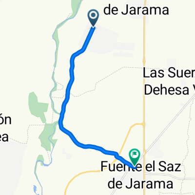
Valdetorres - Uceda - Patones de Arriba - Valdetorres
A cycling route starting in Valdetorres de Jarama, Madrid, Spain.
Overview
About this route
- -:--
- Duration
- 58 km
- Distance
- 446 m
- Ascent
- 449 m
- Descent
- ---
- Avg. speed
- ---
- Max. altitude

Continue with Bikemap
Use, edit, or download this cycling route
You would like to ride Valdetorres - Uceda - Patones de Arriba - Valdetorres or customize it for your own trip? Here is what you can do with this Bikemap route:
Free features
- Save this route as favorite or in collections
- Copy & plan your own version of this route
- Sync your route with Garmin or Wahoo
Premium features
Free trial for 3 days, or one-time payment. More about Bikemap Premium.
- Navigate this route on iOS & Android
- Export a GPX / KML file of this route
- Create your custom printout (try it for free)
- Download this route for offline navigation
Discover more Premium features.
Get Bikemap PremiumFrom our community
Other popular routes starting in Valdetorres de Jarama
 El atazar desde valdetorres
- Distance
- 79.5 km
- Ascent
- 796 m
- Descent
- 795 m
- Location
- Valdetorres de Jarama, Madrid, Spain
 De Calle Rosalía de Castro a Avenida del Pilar
- Distance
- 8.6 km
- Ascent
- 31 m
- Descent
- 76 m
- Location
- Valdetorres de Jarama, Madrid, Spain
 El Casar-Torrelaguna-El Vellón-El Casar
- Distance
- 67.3 km
- Ascent
- 542 m
- Descent
- 535 m
- Location
- Valdetorres de Jarama, Madrid, Spain
 Valdetorres - Uceda - Patones de Arriba - Valdetorres
- Distance
- 58 km
- Ascent
- 446 m
- Descent
- 449 m
- Location
- Valdetorres de Jarama, Madrid, Spain
 Valdetorres, torrelaguna, el berrueco, robledillo de la jara, berzosa, paredes,manjiron,lozoyuela,el berrueco, la Cabrera,torrelaguna,valdetorres.
- Distance
- 102.3 km
- Ascent
- 814 m
- Descent
- 814 m
- Location
- Valdetorres de Jarama, Madrid, Spain
 De Calle del General Mola 1, Valdetorres de Jarama a Calle de Valserrano 3, Algete
- Distance
- 16.6 km
- Ascent
- 395 m
- Descent
- 430 m
- Location
- Valdetorres de Jarama, Madrid, Spain
 Valdetorres (Ruta Norte) - Pontón de la Oliva - El Casar
- Distance
- 56.5 km
- Ascent
- 349 m
- Descent
- 175 m
- Location
- Valdetorres de Jarama, Madrid, Spain
 Ruta moderada en Algete
- Distance
- 15.9 km
- Ascent
- 16 m
- Descent
- 60 m
- Location
- Valdetorres de Jarama, Madrid, Spain
Open it in the app