2017/10
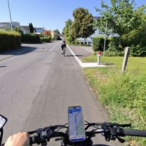
A cycling route starting in Kilchberg / Kilchberg (Dorfkern), Canton of Zurich, Switzerland.
Overview
About this route
- -:--
- Duration
- 199.5 km
- Distance
- 665 m
- Ascent
- 481 m
- Descent
- ---
- Avg. speed
- ---
- Avg. speed
Route quality
Waytypes & surfaces along the route
Waytypes
Quiet road
42.5 km
(21 %)
Track
38.7 km
(19 %)
Surfaces
Paved
162.9 km
(82 %)
Unpaved
22.7 km
(11 %)
Asphalt
150.6 km
(76 %)
Gravel
15.1 km
(8 %)
Route highlights
Points of interest along the route
Point of interest after 63.4 km
Freizeitanlage Rheinwiese - Camping Schaffhausen Hauptstrasse 96c, 8246 Feuerthalen, Switzerland
Point of interest after 116.2 km
BEST WESTERN Hotel Lamm
Continue with Bikemap
Use, edit, or download this cycling route
You would like to ride 2017/10 or customize it for your own trip? Here is what you can do with this Bikemap route:
Free features
- Save this route as favorite or in collections
- Copy & plan your own version of this route
- Sync your route with Garmin or Wahoo
Premium features
Free trial for 3 days, or one-time payment. More about Bikemap Premium.
- Navigate this route on iOS & Android
- Export a GPX / KML file of this route
- Create your custom printout (try it for free)
- Download this route for offline navigation
Discover more Premium features.
Get Bikemap PremiumFrom our community
Other popular routes starting in Kilchberg / Kilchberg (Dorfkern)
- Im Wiesental, Kilchberg ZH to Flughafenstrasse, Kloten
- Distance
- 26.5 km
- Ascent
- 291 m
- Descent
- 288 m
- Location
- Kilchberg / Kilchberg (Dorfkern), Canton of Zurich, Switzerland
- Albispass
- Distance
- 16 km
- Ascent
- 446 m
- Descent
- 444 m
- Location
- Kilchberg / Kilchberg (Dorfkern), Canton of Zurich, Switzerland
- Home to Work Smooth
- Distance
- 24.3 km
- Ascent
- 288 m
- Descent
- 279 m
- Location
- Kilchberg / Kilchberg (Dorfkern), Canton of Zurich, Switzerland
- 2017/007
- Distance
- 307.6 km
- Ascent
- 825 m
- Descent
- 757 m
- Location
- Kilchberg / Kilchberg (Dorfkern), Canton of Zurich, Switzerland
- Kilchberg Sihlwald tour
- Distance
- 36.4 km
- Ascent
- 726 m
- Descent
- 729 m
- Location
- Kilchberg / Kilchberg (Dorfkern), Canton of Zurich, Switzerland
- hirzel/shilbrugg
- Distance
- 33.4 km
- Ascent
- 363 m
- Descent
- 350 m
- Location
- Kilchberg / Kilchberg (Dorfkern), Canton of Zurich, Switzerland
- Kilchberg to Sihlbrugg
- Distance
- 31.5 km
- Ascent
- 458 m
- Descent
- 459 m
- Location
- Kilchberg / Kilchberg (Dorfkern), Canton of Zurich, Switzerland
- Albis Mettmen Buchnegg
- Distance
- 59.8 km
- Ascent
- 1,001 m
- Descent
- 1,000 m
- Location
- Kilchberg / Kilchberg (Dorfkern), Canton of Zurich, Switzerland
Open it in the app