

Buckland Valley - West Kiewa loop
A cycling route starting in Wangaratta, Victoria, Australia.
Overview
About this route
Envisaged as eight-day club ride with rest day below Hotham. Tried to do it in four days but timing was too tight and small errors delayed it enough to have to abort.
- -:--
- Duration
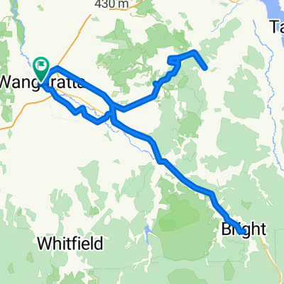
- 332.1 km
- Distance
- 2,378 m
- Ascent
- 2,384 m
- Descent
- ---
- Avg. speed
- ---
- Max. altitude
Continue with Bikemap
Use, edit, or download this cycling route
You would like to ride Buckland Valley - West Kiewa loop or customize it for your own trip? Here is what you can do with this Bikemap route:
Free features
- Save this route as favorite or in collections
- Copy & plan your own version of this route
- Split it into stages to create a multi-day tour
- Sync your route with Garmin or Wahoo
Premium features
Free trial for 3 days, or one-time payment. More about Bikemap Premium.
- Navigate this route on iOS & Android
- Export a GPX / KML file of this route
- Create your custom printout (try it for free)
- Download this route for offline navigation
Discover more Premium features.
Get Bikemap PremiumFrom our community
Other popular routes starting in Wangaratta
 Untitled route
- Distance
- 257.3 km
- Ascent
- 1,873 m
- Descent
- 1,875 m
- Location
- Wangaratta, Victoria, Australia
 Wangaratta to Myrtleford-alt
- Distance
- 54.7 km
- Ascent
- 251 m
- Descent
- 190 m
- Location
- Wangaratta, Victoria, Australia
 Wangaratta to Albury
- Distance
- 112.9 km
- Ascent
- 1,057 m
- Descent
- 1,050 m
- Location
- Wangaratta, Victoria, Australia
 Eva Street 1, Wangaratta to Eva Street 1, Wangaratta
- Distance
- 12.8 km
- Ascent
- 14 m
- Descent
- 15 m
- Location
- Wangaratta, Victoria, Australia
 Wangaratta-Myrtleford-Bright rail trail
- Distance
- 83.3 km
- Ascent
- 354 m
- Descent
- 184 m
- Location
- Wangaratta, Victoria, Australia
 milawa loop
- Distance
- 23.5 km
- Ascent
- 22 m
- Descent
- 22 m
- Location
- Wangaratta, Victoria, Australia
 Wangaratta -Myrtleford rail trail
- Distance
- 56.2 km
- Ascent
- 269 m
- Descent
- 210 m
- Location
- Wangaratta, Victoria, Australia
 Wangaratta Loop
- Distance
- 52.9 km
- Ascent
- 379 m
- Descent
- 382 m
- Location
- Wangaratta, Victoria, Australia
Open it in the app