

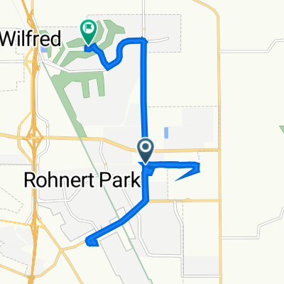
bike tour from Rohnert Park to Santa Rosa
A cycling route starting in Rohnert Park, California, United States.
Overview
About this route
- -:--
- Duration
- 16.2 km
- Distance
- 18 m
- Ascent
- 8 m
- Descent
- ---
- Avg. speed
- ---
- Max. altitude

Continue with Bikemap
Use, edit, or download this cycling route
You would like to ride bike tour from Rohnert Park to Santa Rosa or customize it for your own trip? Here is what you can do with this Bikemap route:
Free features
- Save this route as favorite or in collections
- Copy & plan your own version of this route
- Sync your route with Garmin or Wahoo
Premium features
Free trial for 3 days, or one-time payment. More about Bikemap Premium.
- Navigate this route on iOS & Android
- Export a GPX / KML file of this route
- Create your custom printout (try it for free)
- Download this route for offline navigation
Discover more Premium features.
Get Bikemap PremiumFrom our community
Other popular routes starting in Rohnert Park
 1409 Jasmine Cir, Rohnert Park to 1375 Jasmine Cir, Rohnert Park
- Distance
- 10.7 km
- Ascent
- 45 m
- Descent
- 45 m
- Location
- Rohnert Park, California, United States
 train-bike trail
- Distance
- 8.1 km
- Ascent
- 26 m
- Descent
- 24 m
- Location
- Rohnert Park, California, United States
 38.343° N -122.685° W to 38.366° N -122.700° W
- Distance
- 12.4 km
- Ascent
- 13 m
- Descent
- 19 m
- Location
- Rohnert Park, California, United States
 Long bike tour from Rohnert Park to Santa Rosa
- Distance
- 36.3 km
- Ascent
- 27 m
- Descent
- 16 m
- Location
- Rohnert Park, California, United States
 bike tour from Rohnert Park to Santa Rosa
- Distance
- 16.2 km
- Ascent
- 18 m
- Descent
- 8 m
- Location
- Rohnert Park, California, United States
 dumb route to work
- Distance
- 21.9 km
- Ascent
- 149 m
- Descent
- 126 m
- Location
- Rohnert Park, California, United States
 Rohnet - Santa Rosa - St Helena
- Distance
- 133.3 km
- Ascent
- 1,545 m
- Descent
- 1,544 m
- Location
- Rohnert Park, California, United States
 Safeway
- Distance
- 3.4 km
- Ascent
- 0 m
- Descent
- 0 m
- Location
- Rohnert Park, California, United States
Open it in the app