

fixed VKJ Praděd Dlouhé stráně
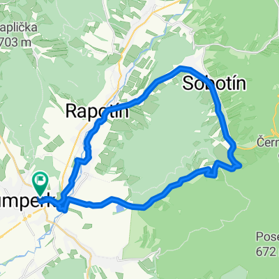
A cycling route starting in Šumperk, Olomoucký kraj, Czechia.
Overview
About this route
14.6.2017
Vrchařská Koruna Jesenicka 2017 Etapa 2. Praděd, Karlova Studánka sedlo, Videlský kříž, Červenohorské sedlo, Dlouhé stráně.
- -:--
- Duration
- 158.8 km
- Distance
- 2,757 m
- Ascent
- 2,759 m
- Descent
- ---
- Avg. speed
- ---
- Max. altitude

Route quality
Waytypes & surfaces along the route
Waytypes
Busy road
74.7 km
(47 %)
Road
34.1 km
(21 %)
Surfaces
Paved
93.2 km
(59 %)
Asphalt
93 km
(59 %)
Paving stones
0.1 km
(<1 %)
Continue with Bikemap
Use, edit, or download this cycling route
You would like to ride fixed VKJ Praděd Dlouhé stráně or customize it for your own trip? Here is what you can do with this Bikemap route:
Free features
- Save this route as favorite or in collections
- Copy & plan your own version of this route
- Split it into stages to create a multi-day tour
- Sync your route with Garmin or Wahoo
Premium features
Free trial for 3 days, or one-time payment. More about Bikemap Premium.
- Navigate this route on iOS & Android
- Export a GPX / KML file of this route
- Create your custom printout (try it for free)
- Download this route for offline navigation
Discover more Premium features.
Get Bikemap PremiumFrom our community
Other popular routes starting in Šumperk
 SSMTB VKJ Rýmařovsko
- Distance
- 95.1 km
- Ascent
- 1,789 m
- Descent
- 1,788 m
- Location
- Šumperk, Olomoucký kraj, Czechia
 Zewl Fest 2008 - Tour de Jeseníky
- Distance
- 124.1 km
- Ascent
- 1,852 m
- Descent
- 1,850 m
- Location
- Šumperk, Olomoucký kraj, Czechia
 Grand Royal Tour De Jeseníky 2009
- Distance
- 150.8 km
- Ascent
- 3,069 m
- Descent
- 2,576 m
- Location
- Šumperk, Olomoucký kraj, Czechia
 Svatební cesta do Jiljí den první
- Distance
- 87 km
- Ascent
- 106 m
- Descent
- 232 m
- Location
- Šumperk, Olomoucký kraj, Czechia
 Šumperk-Hrabová-Stavenice-Úsov-Police-Leština-Šumperk
- Distance
- 55.2 km
- Ascent
- 206 m
- Descent
- 206 m
- Location
- Šumperk, Olomoucký kraj, Czechia
 fixed VKJ Praděd Dlouhé stráně
- Distance
- 158.8 km
- Ascent
- 2,757 m
- Descent
- 2,759 m
- Location
- Šumperk, Olomoucký kraj, Czechia
 Šumperk-Traťovka-Rudoltice-Petrov nad Desnou-Šumperk
- Distance
- 27 km
- Ascent
- 303 m
- Descent
- 303 m
- Location
- Šumperk, Olomoucký kraj, Czechia
 Czech Fixed Tour Etapa 01 Šumperk - Teplice nad Metují
- Distance
- 146.8 km
- Ascent
- 1,607 m
- Descent
- 1,456 m
- Location
- Šumperk, Olomoucký kraj, Czechia
Open it in the app