

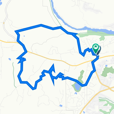
Sacramento River Trail loop
A cycling route starting in Redding, California, United States.
Overview
About this route
- -:--
- Duration
- 22.9 km
- Distance
- 239 m
- Ascent
- 239 m
- Descent
- ---
- Avg. speed
- ---
- Max. altitude

Continue with Bikemap
Use, edit, or download this cycling route
You would like to ride Sacramento River Trail loop or customize it for your own trip? Here is what you can do with this Bikemap route:
Free features
- Save this route as favorite or in collections
- Copy & plan your own version of this route
- Sync your route with Garmin or Wahoo
Premium features
Free trial for 3 days, or one-time payment. More about Bikemap Premium.
- Navigate this route on iOS & Android
- Export a GPX / KML file of this route
- Create your custom printout (try it for free)
- Download this route for offline navigation
Discover more Premium features.
Get Bikemap PremiumFrom our community
Other popular routes starting in Redding
 Easy ride in Redding
- Distance
- 15 km
- Ascent
- 194 m
- Descent
- 180 m
- Location
- Redding, California, United States
 Backyard loop
- Distance
- 13.7 km
- Ascent
- 227 m
- Descent
- 218 m
- Location
- Redding, California, United States
 Rainbow Lake
- Distance
- 31.1 km
- Ascent
- 637 m
- Descent
- 146 m
- Location
- Redding, California, United States
 Wednesday Night Route With Clear Creek Extra
- Distance
- 69.2 km
- Ascent
- 572 m
- Descent
- 567 m
- Location
- Redding, California, United States
 Sacramento River Trail, Redding to Shasta Dam Boulevard 16349, Shasta Lake
- Distance
- 27.1 km
- Ascent
- 474 m
- Descent
- 431 m
- Location
- Redding, California, United States
 Mill Pond Lane 5541, Redding to Mill Pond Lane 5541, Redding
- Distance
- 26.1 km
- Ascent
- 101 m
- Descent
- 101 m
- Location
- Redding, California, United States
 Sacramento River Trail loop
- Distance
- 22.9 km
- Ascent
- 239 m
- Descent
- 239 m
- Location
- Redding, California, United States
 Placer - Keswick Dam Wednesday Night Route
- Distance
- 57.1 km
- Ascent
- 618 m
- Descent
- 641 m
- Location
- Redding, California, United States
Open it in the app