
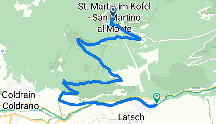
Tschili Trail St.Martin
A cycling route starting in Latsch, Trentino-Alto Adige, Italy.
Overview
About this route
Parking cable car St. Martin 1100 m elevation gain 9 km
- -:--
- Duration
- 8.6 km
- Distance
- 0 m
- Ascent
- 1,103 m
- Descent
- ---
- Avg. speed
- ---
- Max. altitude
Continue with Bikemap
Use, edit, or download this cycling route
You would like to ride Tschili Trail St.Martin or customize it for your own trip? Here is what you can do with this Bikemap route:
Free features
- Save this route as favorite or in collections
- Copy & plan your own version of this route
- Sync your route with Garmin or Wahoo
Premium features
Free trial for 3 days, or one-time payment. More about Bikemap Premium.
- Navigate this route on iOS & Android
- Export a GPX / KML file of this route
- Create your custom printout (try it for free)
- Download this route for offline navigation
Discover more Premium features.
Get Bikemap PremiumFrom our community
Other popular routes starting in Latsch
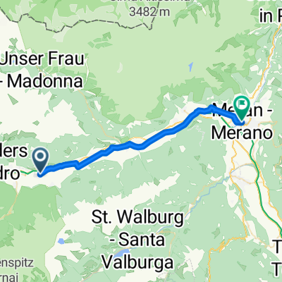 Latsch - Meran
- Distance
- 27.1 km
- Ascent
- 296 m
- Descent
- 273 m
- Location
- Latsch, Trentino-Alto Adige, Italy
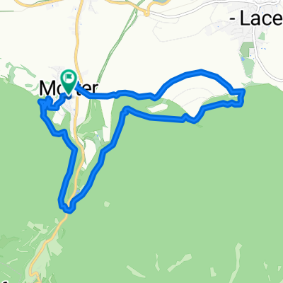
 Freiberger Alm, leicht
- Distance
- 15.2 km
- Ascent
- 947 m
- Descent
- 925 m
- Location
- Latsch, Trentino-Alto Adige, Italy
 an_den_alten_waalwassern_179644249
- Distance
- 10.2 km
- Ascent
- 180 m
- Descent
- 168 m
- Location
- Latsch, Trentino-Alto Adige, Italy
 Tschili Trail St.Martin
- Distance
- 8.6 km
- Ascent
- 0 m
- Descent
- 1,103 m
- Location
- Latsch, Trentino-Alto Adige, Italy
 4er Trail Latscher Alm
- Distance
- 25.1 km
- Ascent
- 1,200 m
- Descent
- 1,200 m
- Location
- Latsch, Trentino-Alto Adige, Italy
 Tag 4 Vinschgau Rotbrunntrail
- Distance
- 11.3 km
- Ascent
- 95 m
- Descent
- 1,351 m
- Location
- Latsch, Trentino-Alto Adige, Italy
 Mals
Mals- Distance
- 49.5 km
- Ascent
- 386 m
- Descent
- 135 m
- Location
- Latsch, Trentino-Alto Adige, Italy
 Latsch Propain Trail Runde S2-S3
- Distance
- 33 km
- Ascent
- 1,291 m
- Descent
- 1,289 m
- Location
- Latsch, Trentino-Alto Adige, Italy
Open it in the app