Obernfeld-Steinkirche
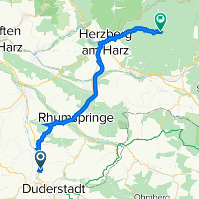
A cycling route starting in Obernfeld, Lower Saxony, Germany.
Overview
About this route
Von Obernfeld bis zur Steinkirche in Scharzfeld
- -:--
- Duration
- 28.5 km
- Distance
- 496 m
- Ascent
- 392 m
- Descent
- ---
- Avg. speed
- ---
- Avg. speed
Route quality
Waytypes & surfaces along the route
Waytypes
Track
17.8 km
(62 %)
Quiet road
7.7 km
(27 %)
Surfaces
Paved
12.5 km
(44 %)
Unpaved
9 km
(32 %)
Gravel
7.7 km
(27 %)
Asphalt
4.8 km
(17 %)
Continue with Bikemap
Use, edit, or download this cycling route
You would like to ride Obernfeld-Steinkirche or customize it for your own trip? Here is what you can do with this Bikemap route:
Free features
- Save this route as favorite or in collections
- Copy & plan your own version of this route
- Sync your route with Garmin or Wahoo
Premium features
Free trial for 3 days, or one-time payment. More about Bikemap Premium.
- Navigate this route on iOS & Android
- Export a GPX / KML file of this route
- Create your custom printout (try it for free)
- Download this route for offline navigation
Discover more Premium features.
Get Bikemap PremiumFrom our community
Other popular routes starting in Obernfeld
- Obernfeld-Steinkirche
- Distance
- 28.5 km
- Ascent
- 496 m
- Descent
- 392 m
- Location
- Obernfeld, Lower Saxony, Germany
- Suthfeldring 9, Duderstadt nach Am Kirchtal, Duderstadt
- Distance
- 35.4 km
- Ascent
- 454 m
- Descent
- 429 m
- Location
- Obernfeld, Lower Saxony, Germany
- Großer Knollen
- Distance
- 26.9 km
- Ascent
- 693 m
- Descent
- 195 m
- Location
- Obernfeld, Lower Saxony, Germany
- Großer Knollen
- Distance
- 25.5 km
- Ascent
- 662 m
- Descent
- 152 m
- Location
- Obernfeld, Lower Saxony, Germany
- Test Knollen
- Distance
- 24.6 km
- Ascent
- 439 m
- Descent
- 124 m
- Location
- Obernfeld, Lower Saxony, Germany
- ok is goed
- Distance
- 25.3 km
- Ascent
- 283 m
- Descent
- 282 m
- Location
- Obernfeld, Lower Saxony, Germany
- Arbeit Offroad
- Distance
- 27.4 km
- Ascent
- 511 m
- Descent
- 531 m
- Location
- Obernfeld, Lower Saxony, Germany
- Recovered Route
- Distance
- 37.6 km
- Ascent
- 561 m
- Descent
- 565 m
- Location
- Obernfeld, Lower Saxony, Germany
Open it in the app