
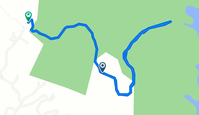
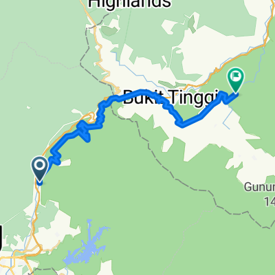
Bike To Lake
A cycling route starting in Kampung Bukit Tinggi, Bentong, Pahang, Malaysia.
Overview
About this route
- -:--
- Duration
- 3.6 km
- Distance
- 113 m
- Ascent
- 149 m
- Descent
- ---
- Avg. speed
- ---
- Max. altitude

Route quality
Waytypes & surfaces along the route
Waytypes
Track
3.6 km
(100 %)
Continue with Bikemap
Use, edit, or download this cycling route
You would like to ride Bike To Lake or customize it for your own trip? Here is what you can do with this Bikemap route:
Free features
- Save this route as favorite or in collections
- Copy & plan your own version of this route
- Sync your route with Garmin or Wahoo
Premium features
Free trial for 3 days, or one-time payment. More about Bikemap Premium.
- Navigate this route on iOS & Android
- Export a GPX / KML file of this route
- Create your custom printout (try it for free)
- Download this route for offline navigation
Discover more Premium features.
Get Bikemap PremiumFrom our community
Other popular routes starting in Kampung Bukit Tinggi
 HOA-Janda Baik
- Distance
- 29.7 km
- Ascent
- 663 m
- Descent
- 402 m
- Location
- Kampung Bukit Tinggi, Bentong, Pahang, Malaysia
 Japanese Garden, Bukit Tinggi
- Distance
- 1.5 km
- Ascent
- 314 m
- Descent
- 77 m
- Location
- Kampung Bukit Tinggi, Bentong, Pahang, Malaysia
 Sempah - Berjaya Hill
- Distance
- 42.6 km
- Ascent
- 2,551 m
- Descent
- 2,551 m
- Location
- Kampung Bukit Tinggi, Bentong, Pahang, Malaysia
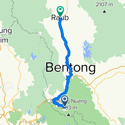 Day02 - Raub
- Distance
- 73.4 km
- Ascent
- 1,151 m
- Descent
- 1,464 m
- Location
- Kampung Bukit Tinggi, Bentong, Pahang, Malaysia
 Bike To Lake
- Distance
- 3.6 km
- Ascent
- 113 m
- Descent
- 149 m
- Location
- Kampung Bukit Tinggi, Bentong, Pahang, Malaysia
 Batu Gombak to Jalan Pesona P8
- Distance
- 22.1 km
- Ascent
- 532 m
- Descent
- 337 m
- Location
- Kampung Bukit Tinggi, Bentong, Pahang, Malaysia
 Jalan Gombak 201, Batu Caves to Jalan Gombak, Bentong
- Distance
- 15.4 km
- Ascent
- 1,119 m
- Descent
- 600 m
- Location
- Kampung Bukit Tinggi, Bentong, Pahang, Malaysia
 Jalan Sumsum Hilir, Bentong to Jalan Iris 3A, Rawang
- Distance
- 84.2 km
- Ascent
- 543 m
- Descent
- 927 m
- Location
- Kampung Bukit Tinggi, Bentong, Pahang, Malaysia
Open it in the app