

Hirschling_Marienthal_Stefling_Jugenberg_Hohenstein_32km_710Hm
A cycling route starting in Brunn, Bavaria, Germany.
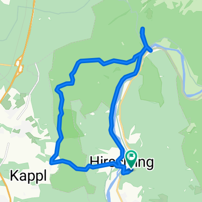
Overview
About this route
Scenic circular route in the Regen valley with technically easy but steep trail descents and short push sections uphill (Km 4.8 for 100m / Km 14.4 for 100m and possibly at Jugenberg Km 16 for 500 - 1000 m due to gradient).
- -:--
- Duration
- 31.5 km
- Distance
- 735 m
- Ascent
- 734 m
- Descent
- ---
- Avg. speed
- ---
- Max. altitude

Route quality
Waytypes & surfaces along the route
Waytypes
Track
18.6 km
(59 %)
Path
8.8 km
(28 %)
Surfaces
Paved
4.4 km
(14 %)
Unpaved
21.8 km
(69 %)
Gravel
12.9 km
(41 %)
Asphalt
4.1 km
(13 %)
Continue with Bikemap
Use, edit, or download this cycling route
You would like to ride Hirschling_Marienthal_Stefling_Jugenberg_Hohenstein_32km_710Hm or customize it for your own trip? Here is what you can do with this Bikemap route:
Free features
- Save this route as favorite or in collections
- Copy & plan your own version of this route
- Sync your route with Garmin or Wahoo
Premium features
Free trial for 3 days, or one-time payment. More about Bikemap Premium.
- Navigate this route on iOS & Android
- Export a GPX / KML file of this route
- Create your custom printout (try it for free)
- Download this route for offline navigation
Discover more Premium features.
Get Bikemap PremiumFrom our community
Other popular routes starting in Brunn
 Hirschling_Marienthal_Stefling_Jugenberg_Hohenstein_32km_710Hm
- Distance
- 31.5 km
- Ascent
- 735 m
- Descent
- 734 m
- Location
- Brunn, Bavaria, Germany
 Hirschling Familienrunde
- Distance
- 11.8 km
- Ascent
- 204 m
- Descent
- 199 m
- Location
- Brunn, Bavaria, Germany
 01 Hirschling
- Distance
- 14 km
- Ascent
- 455 m
- Descent
- 455 m
- Location
- Brunn, Bavaria, Germany
 Hirschling Marienthal Steffling Jugendberg Grafenwinn
- Distance
- 29.9 km
- Ascent
- 582 m
- Descent
- 581 m
- Location
- Brunn, Bavaria, Germany
 Lange Ausfahrt durch Nittenau
- Distance
- 40.6 km
- Ascent
- 324 m
- Descent
- 323 m
- Location
- Brunn, Bavaria, Germany
 Stefling-Cube
- Distance
- 116.5 km
- Ascent
- 4,500 m
- Descent
- 4,337 m
- Location
- Brunn, Bavaria, Germany
 Tagestour Landkreis Schwandorf
- Distance
- 80.8 km
- Ascent
- 327 m
- Descent
- 324 m
- Location
- Brunn, Bavaria, Germany
 Bezirksradtour "M2" Mountainbikestrecke
- Distance
- 13.4 km
- Ascent
- 189 m
- Descent
- 192 m
- Location
- Brunn, Bavaria, Germany
Open it in the app