

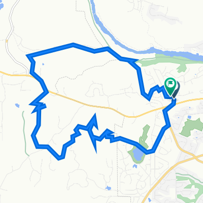
Placer - Keswick Dam Wednesday Night Route
A cycling route starting in Redding, California, United States.
Overview
About this route
Wednesday Night local ride route.
- -:--
- Duration
- 57.1 km
- Distance
- 618 m
- Ascent
- 641 m
- Descent
- ---
- Avg. speed
- 339 m
- Max. altitude

Route quality
Waytypes & surfaces along the route
Waytypes
Busy road
36.6 km
(64 %)
Road
10.4 km
(18 %)
Surfaces
Paved
16.9 km
(30 %)
Asphalt
16.4 km
(29 %)
Paved (undefined)
0.4 km
(<1 %)
Continue with Bikemap
Use, edit, or download this cycling route
You would like to ride Placer - Keswick Dam Wednesday Night Route or customize it for your own trip? Here is what you can do with this Bikemap route:
Free features
- Save this route as favorite or in collections
- Copy & plan your own version of this route
- Sync your route with Garmin or Wahoo
Premium features
Free trial for 3 days, or one-time payment. More about Bikemap Premium.
- Navigate this route on iOS & Android
- Export a GPX / KML file of this route
- Create your custom printout (try it for free)
- Download this route for offline navigation
Discover more Premium features.
Get Bikemap PremiumFrom our community
Other popular routes starting in Redding
 Sacramento River Trail loop
- Distance
- 22.9 km
- Ascent
- 239 m
- Descent
- 239 m
- Location
- Redding, California, United States
 Wednesday Night Route Plus+
- Distance
- 78 km
- Ascent
- 834 m
- Descent
- 816 m
- Location
- Redding, California, United States
 Sacramento River Trail, Redding to Shasta Dam Boulevard 16349, Shasta Lake
- Distance
- 27.1 km
- Ascent
- 474 m
- Descent
- 431 m
- Location
- Redding, California, United States
 Clear Creek Hill
- Distance
- 9.8 km
- Ascent
- 260 m
- Descent
- 102 m
- Location
- Redding, California, United States
 Backyard loop
- Distance
- 13.7 km
- Ascent
- 227 m
- Descent
- 218 m
- Location
- Redding, California, United States
 Wednesday Night Route With Clear Creek Extra
- Distance
- 69.2 km
- Ascent
- 572 m
- Descent
- 567 m
- Location
- Redding, California, United States
 Easy ride in Redding
- Distance
- 15 km
- Ascent
- 194 m
- Descent
- 180 m
- Location
- Redding, California, United States
 Mill Pond Lane 5541, Redding to Mill Pond Lane 5541, Redding
- Distance
- 26.1 km
- Ascent
- 101 m
- Descent
- 101 m
- Location
- Redding, California, United States
Open it in the app