

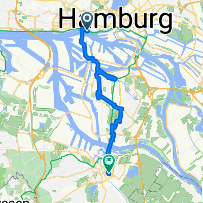
Hafenkante
A cycling route starting in Neustadt, City state of Hamburg, Germany.
Overview
About this route
Let's take a walk along the Elbe
- -:--
- Duration
- 11.7 km
- Distance
- 86 m
- Ascent
- 79 m
- Descent
- ---
- Avg. speed
- ---
- Max. altitude

Route highlights
Points of interest along the route
Point of interest after 0.1 km
Polizeiwache am Brookfleet, bekannt aus der Fernsehserie "Notruf Hafenkante"
Point of interest after 0.1 km
Hanseatic Trade Center
Point of interest after 0.1 km
Elbphilharmonie
Point of interest after 0.4 km
Sportboothafen City
Point of interest after 0.5 km
Historisches Einstiegsgebäude zu Sielnetz
Point of interest after 0.8 km
Cap San Diego
Point of interest after 1.1 km
Rickmer Rickmers
Point of interest after 1.6 km
St.-Pauli-Landungsbrücken
Point of interest after 1.6 km
Alter Elbtunnel
Point of interest after 1.8 km
Trockendock Elbe 17
Point of interest after 2.6 km
Altonaer Fischmarkt
Point of interest after 2.8 km
Fischauktionshalle
Point of interest after 3.5 km
Klärwerk Köhlbrandhof
Point of interest after 3.5 km
Köhlbrandbrücke
Point of interest after 4 km
Dockland
Point of interest after 5.3 km
Seniorenresidenz Augustinum
Point of interest after 5.3 km
Containerterminal Burchardkai
Point of interest after 5.5 km
Museumshafen Oevelgönne
Point of interest after 6.7 km
Schellfischtunnel der Altonaer Hafenbahn
Point of interest after 7 km
Altonaer Balkon
Point of interest after 8.4 km
Lokal Zum Schellfischposten
Point of interest after 8.4 km
Köhlbrandtreppe
Point of interest after 9 km
Park Altonia
Point of interest after 10.2 km
Deutscher Wetterdienst
Point of interest after 10.8 km
Stintfang
Point of interest after 11.3 km
der Hamburger Michel (Sankt Michaelis)
Point of interest after 11.4 km
Angelito Moai von der Osterinsel
Point of interest after 11.6 km
Verlagshaus Gruner und Jahr
Continue with Bikemap
Use, edit, or download this cycling route
You would like to ride Hafenkante or customize it for your own trip? Here is what you can do with this Bikemap route:
Free features
- Save this route as favorite or in collections
- Copy & plan your own version of this route
- Sync your route with Garmin or Wahoo
Premium features
Free trial for 3 days, or one-time payment. More about Bikemap Premium.
- Navigate this route on iOS & Android
- Export a GPX / KML file of this route
- Create your custom printout (try it for free)
- Download this route for offline navigation
Discover more Premium features.
Get Bikemap PremiumFrom our community
Other popular routes starting in Neustadt
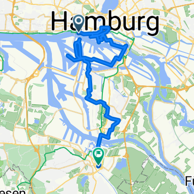
 Fahrt ins Blaue - St. Pauli Landungsbrücken nach Harburg
- Distance
- 17.3 km
- Ascent
- 12 m
- Descent
- 10 m
- Location
- Neustadt, City state of Hamburg, Germany
 Abendrunde nach Fünfhausen (alternative)
- Distance
- 43.8 km
- Ascent
- 60 m
- Descent
- 62 m
- Location
- Neustadt, City state of Hamburg, Germany
 Stadtführung Hamburg, Rundgang St. Pauli von www.stadtspiele-verlag.de
- Distance
- 9.2 km
- Ascent
- 53 m
- Descent
- 43 m
- Location
- Neustadt, City state of Hamburg, Germany
 #8 Hamburg to Glückstadt
- Distance
- 56.6 km
- Ascent
- 175 m
- Descent
- 175 m
- Location
- Neustadt, City state of Hamburg, Germany
 Stadt, Land, Fluß - südliches Hamburg
- Distance
- 60.5 km
- Ascent
- 15 m
- Descent
- 13 m
- Location
- Neustadt, City state of Hamburg, Germany
 Entlang der Elbe
- Distance
- 77 km
- Ascent
- 57 m
- Descent
- 38 m
- Location
- Neustadt, City state of Hamburg, Germany
 Hafen-Erlebnistour_2015
- Distance
- 32.6 km
- Ascent
- 38 m
- Descent
- 36 m
- Location
- Neustadt, City state of Hamburg, Germany
 Hamburg (Alter Elbtunnel) - Halle (Westfalen)
- Distance
- 258 km
- Ascent
- 719 m
- Descent
- 631 m
- Location
- Neustadt, City state of Hamburg, Germany
Open it in the app