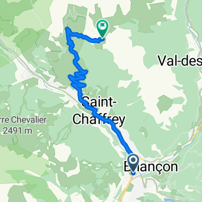
The cycle workshops tour project
A cycling route starting in Brian莽on, Provence-Alpes-C么te d'Azur Region, France.
Overview
About this route
Hello the cycle community! This is my project: join my cycle workshop team at Zilina (Slovakia) from my home (France). The goal is to share about cycle with workshops and passionates on the road.聽So, I hope聽arrived with big motivation and more expective for my voluntary at Recykel organisation.
I do bivouac, camping聽and use Warm Shower website. I travel by my own cycle (that I聽assemble for the opportunity ;-) but I use train too. 聽
See my other maps to see the journey effectively did.
See you on the road!
- -:--
- Duration
- 1,637.6 km
- Distance
- 1,392 m
- Ascent
- 2,376 m
- Descent
- ---
- Avg. speed
- ---
- Max. altitude
Continue with Bikemap
Use, edit, or download this cycling route
You would like to ride The cycle workshops tour project or customize it for your own trip? Here is what you can do with this Bikemap route:
Free features
- Save this route as favorite or in collections
- Copy & plan your own version of this route
- Split it into stages to create a multi-day tour
- Sync your route with Garmin or Wahoo
Premium features
Free trial for 3 days, or one-time payment. More about Bikemap Premium.
- Navigate this route on iOS & Android
- Export a GPX / KML file of this route
- Create your custom printout (try it for free)
- Download this route for offline navigation
Discover more Premium features.
Get Bikemap PremiumFrom our community
Other popular routes starting in Brian莽on
- 3 Briancon Izoard - Montgenevre - Sestriere -Montgenevre
- Distance
- 101 km
- Ascent
- 2,824 m
- Descent
- 2,787 m
- Location
- Brian莽on, Provence-Alpes-C么te d'Azur Region, France
- Col du Galibier via the old road
- Distance
- 52 km
- Ascent
- 1,387 m
- Descent
- 1,239 m
- Location
- Brian莽on, Provence-Alpes-C么te d'Azur Region, France
- p27 Col du Lautaret
- Distance
- 54 km
- Ascent
- 867 m
- Descent
- 1,190 m
- Location
- Brian莽on, Provence-Alpes-C么te d'Azur Region, France
- Brian莽on [Col d'Izoard] loop
- Distance
- 94.2 km
- Ascent
- 1,814 m
- Descent
- 1,814 m
- Location
- Brian莽on, Provence-Alpes-C么te d'Azur Region, France
- Col du Granon k枚r
- Distance
- 66.4 km
- Ascent
- 2,625 m
- Descent
- 2,625 m
- Location
- Brian莽on, Provence-Alpes-C么te d'Azur Region, France
- Colle dell Izoard
- Distance
- 84.5 km
- Ascent
- 1,581 m
- Descent
- 1,579 m
- Location
- Brian莽on, Provence-Alpes-C么te d'Azur Region, France
- briancon-izoard
- Distance
- 20.4 km
- Ascent
- 1,201 m
- Descent
- 155 m
- Location
- Brian莽on, Provence-Alpes-C么te d'Azur Region, France
- Col du Granon, Five Gravel Cols, Two Perched Forts
- Distance
- 72.6 km
- Ascent
- 1,887 m
- Descent
- 1,892 m
- Location
- Brian莽on, Provence-Alpes-C么te d'Azur Region, France
Open it in the app