

Berge rund ums Donautal
A cycling route starting in Kolbingen, Baden-Wurttemberg, Germany.
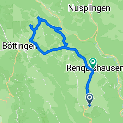
Overview
About this route
The route used to be one of my regular loops, challenging, with a good amount of elevation. Route with light to moderate car traffic. Here you can sharpen your skills for higher mountains.
- -:--
- Duration
- 67.1 km
- Distance
- 1,756 m
- Ascent
- 1,772 m
- Descent
- ---
- Avg. speed
- 890 m
- Max. altitude
Route quality
Waytypes & surfaces along the route
Waytypes
Road
16.1 km
(24 %)
Track
12.7 km
(19 %)
Surfaces
Paved
24.8 km
(37 %)
Unpaved
5.4 km
(8 %)
Asphalt
21.5 km
(32 %)
Paved (undefined)
3.4 km
(5 %)
Continue with Bikemap
Use, edit, or download this cycling route
You would like to ride Berge rund ums Donautal or customize it for your own trip? Here is what you can do with this Bikemap route:
Free features
- Save this route as favorite or in collections
- Copy & plan your own version of this route
- Sync your route with Garmin or Wahoo
Premium features
Free trial for 3 days, or one-time payment. More about Bikemap Premium.
- Navigate this route on iOS & Android
- Export a GPX / KML file of this route
- Create your custom printout (try it for free)
- Download this route for offline navigation
Discover more Premium features.
Get Bikemap PremiumFrom our community
Other popular routes starting in Kolbingen
 Kleine Heubergrunde für wenig Zeit
- Distance
- 23.8 km
- Ascent
- 425 m
- Descent
- 389 m
- Location
- Kolbingen, Baden-Wurttemberg, Germany
 Ursental - Dreifaltigkeitsberg - Bärenthal
- Distance
- 50 km
- Ascent
- 464 m
- Descent
- 463 m
- Location
- Kolbingen, Baden-Wurttemberg, Germany
 2024 - D - Tag 1 - Mühlheim - Sigmaringendorf
- Distance
- 54.5 km
- Ascent
- 1,205 m
- Descent
- 1,269 m
- Location
- Kolbingen, Baden-Wurttemberg, Germany
 Leichte Heubergrunde ab Kolbingen
- Distance
- 15 km
- Ascent
- 197 m
- Descent
- 198 m
- Location
- Kolbingen, Baden-Wurttemberg, Germany
 Runde über den großen Heuberg
- Distance
- 62.1 km
- Ascent
- 762 m
- Descent
- 762 m
- Location
- Kolbingen, Baden-Wurttemberg, Germany
 Heuber Runde
- Distance
- 65.6 km
- Ascent
- 679 m
- Descent
- 674 m
- Location
- Kolbingen, Baden-Wurttemberg, Germany
 Donauradweg von Sigmaringen über Donaueschingen nach Bad Dürrheim und zurück
- Distance
- 561.1 km
- Ascent
- 101 m
- Descent
- 117 m
- Location
- Kolbingen, Baden-Wurttemberg, Germany
 Donau-Radweg: Mühlheim-Sigmaringen
- Distance
- 46.9 km
- Ascent
- 354 m
- Descent
- 421 m
- Location
- Kolbingen, Baden-Wurttemberg, Germany
Open it in the app