

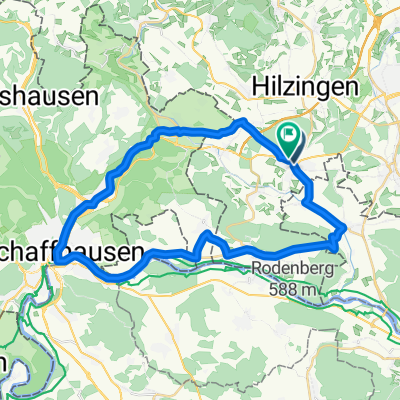
Gottmadingen-Stein am Rhein
A cycling route starting in Gottmadingen, Baden-Württemberg, Germany.
Overview
About this route
- -:--
- Duration
- 17.9 km
- Distance
- 18 m
- Ascent
- 42 m
- Descent
- ---
- Avg. speed
- 435 m
- Max. altitude

Route quality
Waytypes & surfaces along the route
Waytypes
Track
7.8 km
(44 %)
Busy road
4.2 km
(24 %)
Surfaces
Paved
13.1 km
(73 %)
Unpaved
2.5 km
(14 %)
Asphalt
13.1 km
(73 %)
Gravel
2.5 km
(14 %)
Undefined
2.3 km
(13 %)
Continue with Bikemap
Use, edit, or download this cycling route
You would like to ride Gottmadingen-Stein am Rhein or customize it for your own trip? Here is what you can do with this Bikemap route:
Free features
- Save this route as favorite or in collections
- Copy & plan your own version of this route
- Sync your route with Garmin or Wahoo
Premium features
Free trial for 3 days, or one-time payment. More about Bikemap Premium.
- Navigate this route on iOS & Android
- Export a GPX / KML file of this route
- Create your custom printout (try it for free)
- Download this route for offline navigation
Discover more Premium features.
Get Bikemap PremiumFrom our community
Other popular routes starting in Gottmadingen
 Bahnhofstraße 1, Gottmadingen nach Bahnhofstraße 1, Gottmadingen
- Distance
- 6 km
- Ascent
- 107 m
- Descent
- 172 m
- Location
- Gottmadingen, Baden-Württemberg, Germany
 Schiener Berg kurz verspeist.
- Distance
- 72.4 km
- Ascent
- 505 m
- Descent
- 507 m
- Location
- Gottmadingen, Baden-Württemberg, Germany
 Hörirunde1
- Distance
- 61.3 km
- Ascent
- 590 m
- Descent
- 590 m
- Location
- Gottmadingen, Baden-Württemberg, Germany
 Heilsbergtrail
- Distance
- 2.7 km
- Ascent
- 95 m
- Descent
- 113 m
- Location
- Gottmadingen, Baden-Württemberg, Germany
 Gottmadingen-CH-Binningersee-Wasserburgertal-Radolfzell-Gottmadingen
- Distance
- 84.3 km
- Ascent
- 639 m
- Descent
- 634 m
- Location
- Gottmadingen, Baden-Württemberg, Germany
 Variante zum Samstag Nachmittag
- Distance
- 52.4 km
- Ascent
- 332 m
- Descent
- 332 m
- Location
- Gottmadingen, Baden-Württemberg, Germany
 Radolfzeller Aach
- Distance
- 45.3 km
- Ascent
- 452 m
- Descent
- 452 m
- Location
- Gottmadingen, Baden-Württemberg, Germany
 SlowUp Schaffhausen-Hegau
- Distance
- 37 km
- Ascent
- 348 m
- Descent
- 324 m
- Location
- Gottmadingen, Baden-Württemberg, Germany
Open it in the app