

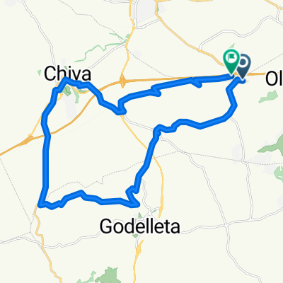
Camping - Cheste - Corrales - Pino - Mojete
A cycling route starting in Cheste, Valencia, Spain.
Overview
About this route
- -:--
- Duration
- 44.1 km
- Distance
- 597 m
- Ascent
- 594 m
- Descent
- ---
- Avg. speed
- ---
- Max. altitude

Continue with Bikemap
Use, edit, or download this cycling route
You would like to ride Camping - Cheste - Corrales - Pino - Mojete or customize it for your own trip? Here is what you can do with this Bikemap route:
Free features
- Save this route as favorite or in collections
- Copy & plan your own version of this route
- Sync your route with Garmin or Wahoo
Premium features
Free trial for 3 days, or one-time payment. More about Bikemap Premium.
- Navigate this route on iOS & Android
- Export a GPX / KML file of this route
- Create your custom printout (try it for free)
- Download this route for offline navigation
Discover more Premium features.
Get Bikemap PremiumFrom our community
Other popular routes starting in Cheste
 Cheste - Fuente Viñas
- Distance
- 35.1 km
- Ascent
- 470 m
- Descent
- 474 m
- Location
- Cheste, Valencia, Spain
 Camping-El Quemao-CV421-Chiva
- Distance
- 26 km
- Ascent
- 283 m
- Descent
- 291 m
- Location
- Cheste, Valencia, Spain
 Valencia
- Distance
- 4 km
- Ascent
- 26 m
- Descent
- 26 m
- Location
- Cheste, Valencia, Spain
 Chiva
Chiva- Distance
- 21.8 km
- Ascent
- 152 m
- Descent
- 215 m
- Location
- Cheste, Valencia, Spain
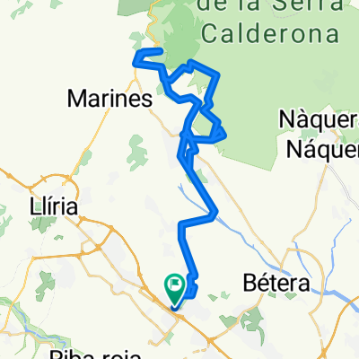 URB. SAN MARTIN - OLOCAU
- Distance
- 51.6 km
- Ascent
- ---
- Descent
- ---
- Location
- Cheste, Valencia, Spain
 calicanto montaña
- Distance
- 29.2 km
- Ascent
- 318 m
- Descent
- 315 m
- Location
- Cheste, Valencia, Spain
 Cracking ride in Cheste
- Distance
- 17.9 km
- Ascent
- 167 m
- Descent
- 164 m
- Location
- Cheste, Valencia, Spain
 Cheste - La manga - Viñas - Cheste
- Distance
- 37.1 km
- Ascent
- 559 m
- Descent
- 559 m
- Location
- Cheste, Valencia, Spain
Open it in the app