

Naturparktour
A cycling route starting in Schorndorf, Baden-Wurttemberg, Germany.
Overview
About this route
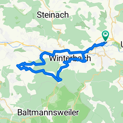
From Schorndorf through the Wielau Valley past Laufenmühle to the Ebnisee. Back via Laufenmühle through the nature park over Haubersbronn to Schorndorf.
- -:--
- Duration
- 50.3 km
- Distance
- 786 m
- Ascent
- 642 m
- Descent
- ---
- Avg. speed
- 569 m
- Max. altitude
Route quality
Waytypes & surfaces along the route
Waytypes
Track
30.7 km
(61 %)
Quiet road
8 km
(16 %)
Surfaces
Paved
29.2 km
(58 %)
Unpaved
19.6 km
(39 %)
Asphalt
27.2 km
(54 %)
Gravel
19.1 km
(38 %)
Continue with Bikemap
Use, edit, or download this cycling route
You would like to ride Naturparktour or customize it for your own trip? Here is what you can do with this Bikemap route:
Free features
- Save this route as favorite or in collections
- Copy & plan your own version of this route
- Sync your route with Garmin or Wahoo
Premium features
Free trial for 3 days, or one-time payment. More about Bikemap Premium.
- Navigate this route on iOS & Android
- Export a GPX / KML file of this route
- Create your custom printout (try it for free)
- Download this route for offline navigation
Discover more Premium features.
Get Bikemap PremiumFrom our community
Other popular routes starting in Schorndorf
 Rund um Schorndorf
- Distance
- 54.2 km
- Ascent
- 948 m
- Descent
- 976 m
- Location
- Schorndorf, Baden-Wurttemberg, Germany
 Schdf-Schnait-Weinstadt-Schdf
- Distance
- 30.8 km
- Ascent
- 450 m
- Descent
- 453 m
- Location
- Schorndorf, Baden-Wurttemberg, Germany
 Naturparktour
- Distance
- 50.3 km
- Ascent
- 786 m
- Descent
- 642 m
- Location
- Schorndorf, Baden-Wurttemberg, Germany
 Schdf-Buoch-Kleinheppach-Rems-Schdf
- Distance
- 32.9 km
- Ascent
- 354 m
- Descent
- 353 m
- Location
- Schorndorf, Baden-Wurttemberg, Germany
 Von Schorndorf bis Stuttgart
- Distance
- 46.4 km
- Ascent
- 235 m
- Descent
- 252 m
- Location
- Schorndorf, Baden-Wurttemberg, Germany
 Königliche Jagd
- Distance
- 35 km
- Ascent
- 501 m
- Descent
- 502 m
- Location
- Schorndorf, Baden-Wurttemberg, Germany
 Schorndorf-Berglen-Gmünd
- Distance
- 80.9 km
- Ascent
- 884 m
- Descent
- 883 m
- Location
- Schorndorf, Baden-Wurttemberg, Germany
 Schorndorf-Bärensee
- Distance
- 34.3 km
- Ascent
- 738 m
- Descent
- 601 m
- Location
- Schorndorf, Baden-Wurttemberg, Germany
Open it in the app