Chambord en 3h
- 74.3 km
- 1,890 m
- 1,901 m
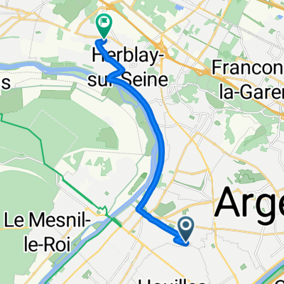
- Sartrouville, Île-de-France Region, France
A cycling route starting in Sartrouville, Île-de-France Region, France.
Overview
100kms in the Vallons with steep climbs like those in Viarmes or Montlignon.
created this 16 years ago
Continue with Bikemap
You would like to ride Argenteuil - Senlis - Argenteuil or customize it for your own trip? Here is what you can do with this Bikemap route:
Free trial for 3 days, or one-time payment. More about Bikemap Premium.
Discover more Premium features.
Get Bikemap PremiumFrom our community
Open it in the app