

Délalföldi Kék
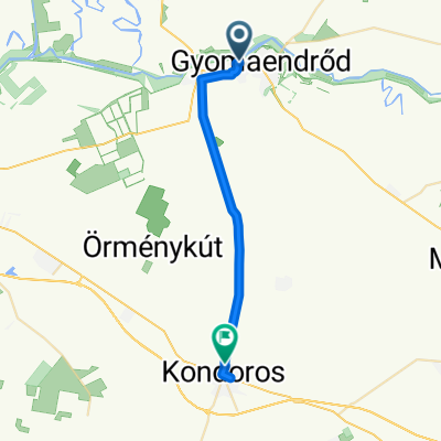
A cycling route starting in Gyomaendrőd, Bekes County, Hungary.
Overview
About this route
- -:--
- Duration
- 560.8 km
- Distance
- 116 m
- Ascent
- 87 m
- Descent
- ---
- Avg. speed
- ---
- Max. altitude
Route quality
Waytypes & surfaces along the route
Waytypes
Track
274.8 km
(49 %)
Quiet road
84.1 km
(15 %)
Surfaces
Paved
145.8 km
(26 %)
Unpaved
112.2 km
(20 %)
Asphalt
145.8 km
(26 %)
Ground
50.5 km
(9 %)
Route highlights
Points of interest along the route
Photo after 22.2 km
5400 Mezőtúr, Bajcsy-Zsilinszky u. 41.
Photo after 60.8 km
Cím: 5515 Ecsegfalva, Fő utca vége, Leírás: Ecsegfalva, a falu végét jelző tábla előtt jobb oldalon, a nemzeti parkos információs táblán (Fő utca). Elérhetősége folyamatos: Igen, Nyitvatartástól függ: Nem
Photo after 67.1 km
Réhelyi Látogatóközpont, MTSZ azonosító: AKPH_28, GPS: N47.0813, E20.9335 Cím: 5510 Dévaványa, Réhely, Leírás: Réhelyi Látogatóközpont, jegypénztár előtti fakorláton. Elérhetősége folyamatos: Nem, Nyitvatartástól függ: Igen, Nyitvatartás: 04. 01 – 10. 31.: K–V: 9–17 H: –
Photo after 95 km
Dévaványa, MTSZ azonosító: AKPH_29, GPS: N47.0340110, E20.943543 Cím: 5510 Dévaványa, MÁV-állomás, Leírás: Dévaványa vasútállomás pénztáránál. Elérhetősége folyamatos: Nem, Nyitvatartástól függ: Igen, Nyitvatartás: H–Szo: 5–9; 13.30 – 18.30 V: 9.50 – 18.20
Photo after 107.7 km
Vidratanya, MTSZ azonosító: AKPH_31_1, GPS: N46.9863, E21.1838 Cím: 5520 Szeghalom, Fok-közi gátőrház, Leírás: Vidratanya, Szeghalom, Fok-közi gátőrház Elérhetősége folyamatos: Nem, Nyitvatartástól függ: Igen, Nyitvatartás: Ameddig a nagy kapu nyitva van.
Photo after 113.1 km
Csolt-monostor, MTSZ azonosító: AKPH_32, GPS: N46.939751, E21.214678 Cím: 5530 Vésztő, Leírás: Csolt-monostor, Vésztő–Mágor Történelmi Emlékhely, a juhászok szállásánál. Elérhetősége folyamatos: Igen, Nyitvatartástól függ: Nem
Photo after 120 km
Vésztő vá., MTSZ azonosító: AKPH_33, GPS: N46.9388, E21.2636 Cím: 5530 Vésztő, Bartók Béla út 27–29., Leírás: Vésztő vasútállomás pénztáránál. Elérhetősége folyamatos: Nem, Nyitvatartástól függ: Igen, Nyitvatartás: H–V: 7.50 – 22.50
Accommodation after 123.9 km
Musli-sziget Panzió & Étterem, SZÉP, kerékpár teraszon, 3000 Ft/fő. TESZ kártya 10%.
Photo after 131.8 km
Okány, MTSZ azonosító: AKPH_34, GPS: N46.89879, E21.342673 Cím: 5534 Okány, Kossuth utca 47., Leírás: Okány, Soma söröző belső falán. Elérhetősége folyamatos: Nem, Nyitvatartástól függ: Igen, Nyitvatartás: H–V: 6–21
Photo after 174 km
Zsadány, MTSZ azonosító: AKPH_35, GPS: N46.920624, E21.486934 Cím: 5537 Zsadány, Lengyel Ferenc utca 5., Leírás: Zsadány, BNS üzletház pénztáránál. Elérhetősége folyamatos: Nem, Nyitvatartástól függ: Igen, Nyitvatartás: H–Szo: 6–18 V: 7–13
Photo after 185.2 km
Geszt, MTSZ azonosító: AKPH_36, GPS: N46.8837331348845, E21.5788543224334 Cím: 5734 Geszt, Arany János utca 1., Leírás: Geszt, Tisza-kastély Arany János-emlékházban (iskolaként üzemel). Elérhetősége folyamatos: Nem, Nyitvatartástól függ: Igen, Nyitvatartás: H–P: 8–16 Szo–V: előre egyeztetni 66/496-065
Photo after 195.3 km
Biharugra, MTSZ azonosító: AKPH_37, GPS: N46.970175, E21.600997 Cím: 5538 Biharugra, Erzsébet utca 76., Leírás: Biharugra, Makk hetes sörözőben. Elérhetősége folyamatos: Nem, Nyitvatartástól függ: Igen, Nyitvatartás: H–Cs.: 5.30 – 21.30; P–Sz: 5.30 – 22; V: 5.30 – 21.30
Photo after 206.9 km
Körösnagyharsány, MTSZ azonosító: AKPH_38, GPS: N47.005138, E21.639389 Cím: 5539 Körösnagyharsány, Váradi út 66., Leírás: Körösnagyharsány, italboltban. Elérhetősége folyamatos: Nem, Nyitvatartástól függ: Igen, Nyitvatartás: H–V: 6–22
Photo after 212 km
Körösszakál, MTSZ azonosító: AKPH_39, GPS: N47.019118, E21.592165 Cím: 4136 Körösszakál, Templom út 2., Leírás: Körösszakál, Forza Milan söröző bárpultjánál. Elérhetősége folyamatos: Nem, Nyitvatartástól függ: Igen, Nyitvatartás: H–P: 6–22 Sz–V: 6–24
Accommodation after 212 km
Önkormányzati szállás, 1500 ft. A komádi zsole’s pizzériából lehet kaját rendelni. Kerékpár zárt helyen.
Photo after 231.5 km
Furta, MTSZ azonosító: AKPH_40, GPS: N47.1287, E21.456 Cím: 4141 Furta, Szabadság utca 2., Leírás: Furta, Hangulat presszó bárpultjánál. Elérhetősége folyamatos: Nem, Nyitvatartástól függ: Igen, Nyitvatartás: H–Cs: 6–21 P–Szo: 6–02
Photo after 241.5 km
Bakonszeg, Bessenyei emlékház, MTSZ azonosító: AKPH_41, GPS: N47.192394, E21.459403 Cím: 4164 Bakonszeg, Hunyadi utca 103., Leírás: Bakonszeg, a Bessenyei György-emlékház udvarán lévő villanyoszlopon. Elérhetősége folyamatos: Nem, Nyitvatartástól függ: Igen, Nyitvatartás: Elérhetőség: 30/297-6057
Point of interest after 248.1 km
2017.05.16. K Berettyóújfalu http://www.jurtaudulohazak.hu/kapcsolat Négyágyas faházak , 3000Ft Törölköző, ágynemű, konyha, elektromos lap (mikró nincs), Wifi Kajarendelés városból, pl pizza.
Photo after 248.7 km
Berettyóújfalu, MTSZ azonosító: AKPH_42, GPS: N47.2098, E21.5379 Cím: 4101 Berettyóújfalu, Berettyólapos 1., Leírás: Berettyóújfalu, TVIZIG bejáratánál, a kerítésen. Elérhetősége folyamatos: Igen, Nyitvatartástól függ: Nem
Photo after 266.6 km
Hencida, MTSZ azonosító: AKPH_43, GPS: N47.2504, E21.6968 Cím: 4123 Hencida, Kossuth tér 8., Leírás: Hencida, Reál élelmiszerboltban. Elérhetősége folyamatos: Nem, Nyitvatartástól függ: Igen, Nyitvatartás: H–P: 6–19 Szo: 6–12; 14–19 V: 7–12; 15–19
Photo after 281 km
Nagykereki, MTSZ azonosító: AKPH_44_2, GPS: N47.1865, E21.7955 Cím: 4127 Nagykereki, Kossuth utca 7., Leírás: Nagykereki, Reál Pont élelmiszerboltban. Elérhetősége folyamatos: Nem, Nyitvatartástól függ: Igen, Nyitvatartás: H–P: 6–18 Szo: 6–14 V: 6.30 – 11
Photo after 281.5 km
Nagykereki, MTSZ azonosító: AKPH_44_1, GPS: N47.1876, E21.8007 Cím: 4127 Nagykereki, Bocskai tér 1., Leírás: Bocskai-kastély (a könyvtárban). Elérhetősége folyamatos: Nem, Nyitvatartástól függ: Igen, Nyitvatartás: H–CS: 8–16 P: 8– 18.30 Szo–V: –
Photo after 289.2 km
Kismarja, MTSZ azonosító: AKPH_45_2, GPS: N47.2453, E21.8227 Cím: 4126 Kismarja, Petőfi utca 2., Leírás: Kismarja, Kisvadász kocsmában. Elérhetősége folyamatos: Nem, Nyitvatartástól függ: Igen, Nyitvatartás: H–V: 6–14
Photo after 289.7 km
Kismarja, MTSZ azonosító: AKPH_45_1, GPS: N47.2482, E21.8266 Cím: 4126 Kismarja, Bethlen Gábor utca 3., Leírás: Kismarja, református templomban. Elérhetősége folyamatos: Nem, Nyitvatartástól függ: Igen, Nyitvatartás: Folyamatos, elérhetőség: 20/519-3001
Photo after 293.9 km
Pocsaj, VIZIG kerítése, MTSZ azonosító: AKPH_46_3, GPS: N47.278564, E21.804838 Cím: 4125 Pocsaj, Rákóczi út 14., Leírás: Pocsaj, VIZIG-kerítés (átemelő szivattyú kerítésén). Elérhetősége folyamatos: Igen, Nyitvatartástól függ: Nem
Photo after 294.9 km
Pocsaj, MTSZ azonosító: AKPH_46_1, GPS: N47.2843, E21.8117 Cím: 4125 Pocsaj, Piac u. 26., Leírás: Pocsaj, Papa sörözőben. Elérhetősége folyamatos: Nem, Nyitvatartástól függ: Igen, Nyitvatartás: H–V: 6–21
Photo after 296.4 km
Pocsaj, MTSZ azonosító: AKPH_46_2, GPS: N47.2862, E21.8265 Cím: 4125 Pocsaj, Petőfi utca 38–40., Leírás: Pocsaj, Sinka Miska vendégház. Elérhetősége folyamatos: Nem, Nyitvatartástól függ: Igen, Nyitvatartás: Telefonon egyeztetni: 06-20-921-5663; 06-20-521-3117
Photo after 306.8 km
Cserekert, MTSZ azonosító: AKPH_47, GPS: N47.3204, E21.8913 Cím: 4125 Létavértes-Cserekert, Hajnal utca 22., Leírás: Cserekert, magánház kerítésén. Elérhetősége folyamatos: Igen, Nyitvatartástól függ: Nem
Photo after 313.9 km
Létavértes, Korona Presszó, MTSZ azonosító: AKPH_48, GPS: N47.380839, E21.892347 Cím: 4281 Létavértes, Rózsa utca 2., Leírás: Létavértes, Korona presszó bárpultjában. Elérhetősége folyamatos: Nem, Nyitvatartástól függ: Igen, Nyitvatartás: H–Cs: 8–22; P–Szo: 8–23; V: 8–22
Accommodation after 314.8 km
2017.05.17. SZE Létevértes: Szent Kristóf Ifjúsági Szálláshely: Létavértes 4281 Batthyány út 53. Hűtő, mikró, teafőző. Étterem, pizzázó közelben. Wifi,. Ágynemű. Kerékpár zárt udvarban. 2500 Ft/fő. http://szallasetteremkereso.hu/vendeglatohely/szent-kristof-ifjusagi-szallashely/
Photo after 324.7 km
Álmosd, MTSZ azonosító: AKPH_49_1, GPS: N47.4146, E21.9788 Cím: 4285 Álmosd, Kölcsey utca 13., Leírás: Álmosd, Kölcsey-emlékházban. Elérhetősége folyamatos: Nem, Nyitvatartástól függ: Igen, Nyitvatartás: bejelentkezés: 06-52-399-064 06-30-920-5380 06-52-388-035
Photo after 336.3 km
Kepecstag, MTSZ azonosító: AKPH_50, GPS: N47.4223, E21.8659 Cím: , Leírás: Kepecstag, helyi információs táblán. Elérhetősége folyamatos: Igen, Nyitvatartástól függ: Nem
Photo after 365.8 km
Vekeri-tó, MTSZ azonosító: AKPH_51_2, GPS: N47.448699, E21.689346 Cím: 4002 Debrecen, Erdőspuszta, Leírás: Vekeri-tó, Dorcas kemping portáján. Elérhetősége folyamatos: Igen, Nyitvatartástól függ: Nem, Nyitvatartás: állandó
Photo after 366.2 km
Vekeri-tó, MTSZ azonosító: AKPH_51_1, GPS: N47.4528, E21.6849 Cím: , Leírás: Csónakház épületén belül. Elérhetősége folyamatos: Igen, Nyitvatartástól függ: Nem, Nyitvatartás: állandó
Photo after 367.3 km
Bánk, MTSZ azonosító: AKPH_52_1, GPS: N47.487, E21.7185 Cím: 4079 Bánk, Fancsika tanya 93/A, Leírás: Erdőspusztai Bemutatóházban. Elérhetősége folyamatos: Igen, Nyitvatartástól függ: Nem
Photo after 371.4 km
Bánk, MTSZ azonosító: AKPH_52_2, GPS: N47.4811510, E21.7163610 Cím: 4200 Erdőspuszta, Arbo Lovastanya portája, Leírás: Arbo Lovastanya tervezett főbejáratnál. Elérhetősége folyamatos: Igen, Nyitvatartástól függ: Nem
Photo after 383.2 km
Halápi csárda, MTSZ azonosító: AKPH_53, GPS: N47.5292, E21.8152 Cím: Információs tábla (a hajdani csárda előtt)., Leírás: Információs táblán (a hajdani csárda előtt). Elérhetősége folyamatos: Igen, Nyitvatartástól függ: Nem
Photo after 404.3 km
Nyíracsád, MTSZ azonosító: AKPH_54, GPS: N47.6018, E21.97 Cím: 4262 Nyíracsád, Kassai út 6., Leírás: Ligetalja Közművelődési és Turisztikai Központban. Elérhetősége folyamatos: Nem, Nyitvatartástól függ: Igen, Nyitvatartás: H: 8–20; K: 8–18; Sz: 8–16; Cs: 8–21; P: 8–18; Szo: 10–13
Accommodation after 404.6 km
2017.05.18. Cs Nyíracsád Görög Katolikus parókia tulajdonában lévő vendégház (Kossuth út 5-7 .) Vacsizni a Pizza Tanya nevű helyen lehetett. Adomány 1500 Ft. Számla nincs. Ágynemű, zuhanyzó. Kerékpár zárt udvarban.
Photo after 417.2 km
Nyírlugos, MTSZ azonosító: AKPH_55, GPS: N47.692975, E22.041554 Cím: 4371 Nyírlugos, Fő utca 13., Leírás: Nyírlugos, Pardiso presszóban. Elérhetősége folyamatos: Nem, Nyitvatartástól függ: Igen, Nyitvatartás: H: 8–20; K: 8–18; Sze: 8–16; Cs: 8–21; P: 8–18; Szo: 10–13
Photo after 430.3 km
Istvántanya, MTSZ azonosító: AKPH_56, GPS: N47.7797, E22.0659 Cím: 4361 Nyírbogát-Istvántanya, Béke út 6/B, Leírás: Istvántanya, Fapados büfében. Elérhetősége folyamatos: Nem, Nyitvatartástól függ: Igen, Nyitvatartás: H–V: 6–19
Photo after 441.7 km
Nyírbátor, MTSZ azonosító: AKPH_57, GPS: N47.8373, E22.1277 Cím: 4300 Nyírbátor ,Károlyi Mihály 21., Leírás: Nyírbátor, Báthori-múzeumban a pénztárnál. Elérhetősége folyamatos: Nem, Nyitvatartástól függ: Igen, Nyitvatartás: Ápr. 1. – szept. 3.: hétfő kivételével mindennap 10–18 óráig. Okt. 1. – márc. 31.: H–P: 8–16; Szombat–Vasárnap: zárva
Accommodation after 443 km
2017.05.19. P Nyírbátor Bátor Park Panzió, http://www.batorpark.fw.hu/ 4300, Nyírbátor, Madách u. 34.
Photo after 452.4 km
Nyírderzs, MTSZ azonosító: AKPH_58, GPS: N47.896384, E22.162306 Cím: 4332 Nyírderzs, Báthori út 19., Leírás: Nyírderzs, Hangulat büfé belső falán. Elérhetősége folyamatos: Nem, Nyitvatartástól függ: Igen, Nyitvatartás: H–V: 6–22
Photo after 463.3 km
Vaja, MTSZ azonosító: AKPH_59, GPS: N47.991797, E22.153136 Cím: 4562 Vaja, Török Ignác utca 41., Leírás: Vaja, Bombajó élelmiszerboltban. Elérhetősége folyamatos: Nem, Nyitvatartástól függ: Igen, Nyitvatartás: H–Sz: 7–19; V: 7–16
Photo after 474.9 km
Nyírkarász, MTSZ azonosító: AKPH_60, GPS: N48.096696, E22.100975 Cím: 4544 Nyírkarász, Szabadság tér 2., Leírás: Nyírkarász, Tölgyfa presszóban. Elérhetősége folyamatos: Igen, Nyitvatartástól függ: Nem, Nyitvatartás: H–V: 6–23
Photo after 482 km
Gyulaháza, MTSZ azonosító: AKPH_61, GPS: N48.1396, E22.109 Cím: 4545 Gyulaháza, Kossuth Lajos utca 4., Leírás: Gyulaháza, serfőzde épületén kívül, a bejáratnál. Elérhetősége folyamatos: Igen, Nyitvatartástól függ: Nem
Photo after 490.9 km
Kisvárda, MTSZ azonosító: AKPH_62_1, GPS: N48.2086, E22.0781 Cím: 4600 Kisvárda, Baross Gábor utca 23., Leírás: Kisvárda vasútállomás várótermének bejárata mellett, kívül. Elérhetősége folyamatos: Igen, Nyitvatartástól függ: Nem
Accommodation after 492.8 km
2017.05.20. Szo Kisvárda Bessenyei György Gimnázium és Kollégium, 4600 Kisvárda, Iskola tér 2. A szállás ára: 2700 Ft/fő/éj. Teljesen felszerelt és felújított kollégium, rögtön mellette pedig egy kiváló kis étterem finom ételekkel és baráti árakkal.
Photo after 494.7 km
Kisvárda, MTSZ azonosító: AKPH_62_2, GPS: N48.230311, E22.069211 Cím: , Leírás: A strandfürdő sarkán, az útjelző oszlopon. Elérhetősége folyamatos: Igen, Nyitvatartástól függ: Nem
Photo after 509.1 km
Tiszakanyár, MTSZ azonosító: AKPH_63, GPS: N48.2464, E21.963 Cím: 4493 Tiszakanyár, Fő út 20., Leírás: Anita büfé kül
Photo after 526.7 km
Cigándi gátőrház, MTSZ azonosító: AKPH_64, GPS: N48.2787, E21.8326 Cím: Cigánd és Pácin között, Leírás: A gátőrház előtti villanyoszlopon. Elérhetősége folyamatos: Igen, Nyitvatartástól függ: Nem
Photo after 533.4 km
Pácin, MTSZ azonosító: AKPH_65, GPS: N48.3303, E21.8285 Cím: 3964 Pácin, Kossuth kert 1., Leírás: A kastély pénztáránál a falon, belül. Elérhetősége folyamatos: Nem, Nyitvatartástól függ: Igen
Photo after 538.8 km
Karcsa, MTSZ azonosító: AKPH_66, GPS: N48.315214205, E21.79470509 Cím: 3963 Karcsa, Alkotmány utca 3., Leírás: A református templom előtti hirdetőtáblán. Elérhetősége folyamatos: Igen, Nyitvatartástól függ: Nem
Photo after 553.1 km
Alsóberecki, MTSZ azonosító: AKPH_67, GPS: N48.340217, E21.6865 Cím: 3985 Alsóberecki, Rákóczi út 40., Leírás: A Csokány bisztróban, a pult mellett a falon. Elérhetősége folyamatos: Nem, Nyitvatartástól függ: Igen, Nyitvatartás: H–V: 8–21
Photo after 560.8 km
Sátoraljaújhely, MTSZ azonosító: OKTPH_143_AKPH_69, GPS: N48.3862, E21.6574 Cím: 3980 Sátoraljaújhely, Fasor utca 19., Leírás: Sátoraljaújhely vasútállomás pénztára mellett, a falon. Elérhetősége folyamatos: Nem, Nyitvatartástól függ: Igen, Nyitvatartás: H–V: 3.30 – 23.50
Continue with Bikemap
Use, edit, or download this cycling route
You would like to ride Délalföldi Kék or customize it for your own trip? Here is what you can do with this Bikemap route:
Free features
- Save this route as favorite or in collections
- Copy & plan your own version of this route
- Split it into stages to create a multi-day tour
- Sync your route with Garmin or Wahoo
Premium features
Free trial for 3 days, or one-time payment. More about Bikemap Premium.
- Navigate this route on iOS & Android
- Export a GPX / KML file of this route
- Create your custom printout (try it for free)
- Download this route for offline navigation
Discover more Premium features.
Get Bikemap PremiumFrom our community
Other popular routes starting in Gyomaendrőd
 Körös parti tekerés
- Distance
- 29.9 km
- Ascent
- 5 m
- Descent
- 8 m
- Location
- Gyomaendrőd, Bekes County, Hungary
 Batthyány Lajos utca 6., Gyomaendrőd-Batthyány Lajos utca 3., Gyomaendrőd
- Distance
- 10.3 km
- Ascent
- 45 m
- Descent
- 44 m
- Location
- Gyomaendrőd, Bekes County, Hungary
 Slow ride in Kondoros
- Distance
- 24.1 km
- Ascent
- 21 m
- Descent
- 17 m
- Location
- Gyomaendrőd, Bekes County, Hungary
 július 4
- Distance
- 83.1 km
- Ascent
- 64 m
- Descent
- 62 m
- Location
- Gyomaendrőd, Bekes County, Hungary
 július 4
- Distance
- 82.9 km
- Ascent
- 59 m
- Descent
- 57 m
- Location
- Gyomaendrőd, Bekes County, Hungary
 Délalföldi Kék
- Distance
- 560.8 km
- Ascent
- 116 m
- Descent
- 87 m
- Location
- Gyomaendrőd, Bekes County, Hungary
 Kőrös sor 24, Gyomaendrőd - Kőrös sor 24, Gyomaendrőd
- Distance
- 18.5 km
- Ascent
- 59 m
- Descent
- 116 m
- Location
- Gyomaendrőd, Bekes County, Hungary
 július 4/f
- Distance
- 12.1 km
- Ascent
- 16 m
- Descent
- 17 m
- Location
- Gyomaendrőd, Bekes County, Hungary
Open it in the app