Kun Kör 2017
A cycling route starting in Kerekegyháza, Bács-Kiskun county, Hungary.
Overview
About this route
- -:--
- Duration
- 47.7 km
- Distance
- 39 m
- Ascent
- 39 m
- Descent
- ---
- Avg. speed
- ---
- Avg. speed
Route quality
Waytypes & surfaces along the route
Waytypes
Busy road
32.3 km
(68 %)
Quiet road
7.7 km
(16 %)
Surfaces
Paved
16.5 km
(35 %)
Unpaved
0.1 km
(<1 %)
Asphalt
16.5 km
(35 %)
Gravel
0.1 km
(<1 %)
Undefined
31.1 km
(65 %)
Continue with Bikemap
Use, edit, or download this cycling route
You would like to ride Kun Kör 2017 or customize it for your own trip? Here is what you can do with this Bikemap route:
Free features
- Save this route as favorite or in collections
- Copy & plan your own version of this route
- Sync your route with Garmin or Wahoo
Premium features
Free trial for 3 days, or one-time payment. More about Bikemap Premium.
- Navigate this route on iOS & Android
- Export a GPX / KML file of this route
- Create your custom printout (try it for free)
- Download this route for offline navigation
Discover more Premium features.
Get Bikemap PremiumFrom our community
Other popular routes starting in Kerekegyháza
- Winter Kúp 2017/18 I.forduló
- Distance
- 8.6 km
- Ascent
- 24 m
- Descent
- 23 m
- Location
- Kerekegyháza, Bács-Kiskun county, Hungary
- Kun Kör 2017
- Distance
- 47.7 km
- Ascent
- 39 m
- Descent
- 39 m
- Location
- Kerekegyháza, Bács-Kiskun county, Hungary
- Kerek 80 TT
- Distance
- 77.1 km
- Ascent
- 38 m
- Descent
- 38 m
- Location
- Kerekegyháza, Bács-Kiskun county, Hungary
- Szigeti kör
- Distance
- 211 km
- Ascent
- 58 m
- Descent
- 58 m
- Location
- Kerekegyháza, Bács-Kiskun county, Hungary
- Bucka túra
- Distance
- 45.3 km
- Ascent
- 43 m
- Descent
- 46 m
- Location
- Kerekegyháza, Bács-Kiskun county, Hungary
- 2013.03.15/1
- Distance
- 107.6 km
- Ascent
- 69 m
- Descent
- 66 m
- Location
- Kerekegyháza, Bács-Kiskun county, Hungary
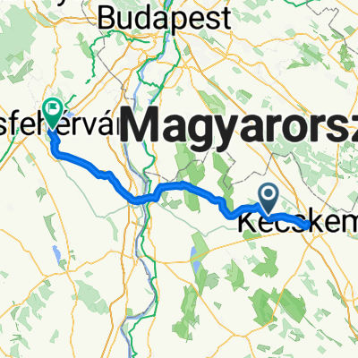
- Vörösmarty utca 13, Kerekegyháza - Arany János utca 38, Kerekegyháza
- Distance
- 2.9 km
- Ascent
- 0 m
- Descent
- 0 m
- Location
- Kerekegyháza, Bács-Kiskun county, Hungary
- Töserdő(kerülő)
- Distance
- 131 km
- Ascent
- 60 m
- Descent
- 56 m
- Location
- Kerekegyháza, Bács-Kiskun county, Hungary