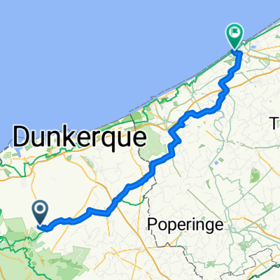
La grande route des Monts de Flandres
A cycling route starting in Watten, Hauts-de-France, France.
Overview
About this route
- -:--
- Duration
- 135.7 km
- Distance
- 587 m
- Ascent
- 566 m
- Descent
- ---
- Avg. speed
- ---
- Max. altitude
Route quality
Waytypes & surfaces along the route
Waytypes
Quiet road
53.9 km
(40 %)
Busy road
24.6 km
(18 %)
Surfaces
Paved
78 km
(57 %)
Unpaved
22.9 km
(17 %)
Asphalt
74.5 km
(55 %)
Gravel
19.5 km
(14 %)
Route highlights
Points of interest along the route
Point of interest after 18.5 km
Point of interest after 24.4 km
Point of interest after 26.8 km
Point of interest after 42.7 km
Point of interest after 44.2 km
Point of interest after 46.4 km
Point of interest after 49.6 km
Point of interest after 51.3 km
Point of interest after 51.4 km
Point of interest after 52.2 km
Point of interest after 57.1 km
Point of interest after 114.2 km
Mont St Aubert
Point of interest after 128.9 km
Mont de l'Englus
Continue with Bikemap
Use, edit, or download this cycling route
You would like to ride La grande route des Monts de Flandres or customize it for your own trip? Here is what you can do with this Bikemap route:
Free features
- Save this route as favorite or in collections
- Copy & plan your own version of this route
- Split it into stages to create a multi-day tour
- Sync your route with Garmin or Wahoo
Premium features
Free trial for 3 days, or one-time payment. More about Bikemap Premium.
- Navigate this route on iOS & Android
- Export a GPX / KML file of this route
- Create your custom printout (try it for free)
- Download this route for offline navigation
Discover more Premium features.
Get Bikemap PremiumFrom our community
Other popular routes starting in Watten
- La grande route des Monts de Flandres
- Distance
- 135.7 km
- Ascent
- 587 m
- Descent
- 566 m
- Location
- Watten, Hauts-de-France, France
- 31. Watten to Nieuwport 79km
- Distance
- 79.8 km
- Ascent
- 104 m
- Descent
- 107 m
- Location
- Watten, Hauts-de-France, France
- La boucle des Monts de Flandres
- Distance
- 115.3 km
- Ascent
- 611 m
- Descent
- 611 m
- Location
- Watten, Hauts-de-France, France
- auchel grande synthe part3
- Distance
- 21.3 km
- Ascent
- 4 m
- Descent
- 4 m
- Location
- Watten, Hauts-de-France, France
- R1 - 2 - Watten - digsmuide
- Distance
- 68.1 km
- Ascent
- 3 m
- Descent
- 7 m
- Location
- Watten, Hauts-de-France, France
- Frankrijk 1
- Distance
- 334.6 km
- Ascent
- 1,914 m
- Descent
- 1,951 m
- Location
- Watten, Hauts-de-France, France
- 62 Watten Balade du 11 mai 15
- Distance
- 104.9 km
- Ascent
- 537 m
- Descent
- 538 m
- Location
- Watten, Hauts-de-France, France
- tour de saint omer
- Distance
- 39 km
- Ascent
- 143 m
- Descent
- 142 m
- Location
- Watten, Hauts-de-France, France
Open it in the app