

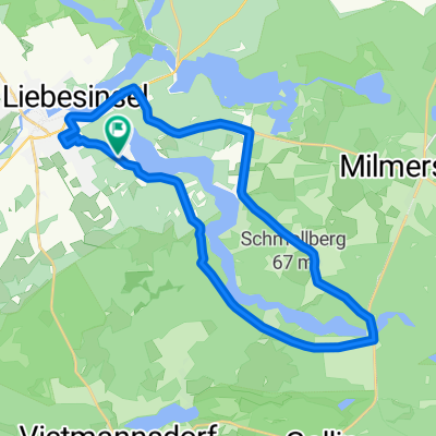
20150515_102952.gpx
A cycling route starting in Templin, Brandenburg, Germany.
Overview
About this route
TAHUNA track
- -:--
- Duration
- 1.9 km
- Distance
- 4 m
- Ascent
- 5 m
- Descent
- ---
- Avg. speed
- ---
- Max. altitude

Continue with Bikemap
Use, edit, or download this cycling route
You would like to ride 20150515_102952.gpx or customize it for your own trip? Here is what you can do with this Bikemap route:
Free features
- Save this route as favorite or in collections
- Copy & plan your own version of this route
- Sync your route with Garmin or Wahoo
Premium features
Free trial for 3 days, or one-time payment. More about Bikemap Premium.
- Navigate this route on iOS & Android
- Export a GPX / KML file of this route
- Create your custom printout (try it for free)
- Download this route for offline navigation
Discover more Premium features.
Get Bikemap PremiumFrom our community
Other popular routes starting in Templin
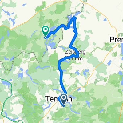
 Um den Lübbesee (2)
- Distance
- 23.1 km
- Ascent
- 154 m
- Descent
- 150 m
- Location
- Templin, Brandenburg, Germany
 Tour 2020 - Tag 1
- Distance
- 100 km
- Ascent
- 126 m
- Descent
- 150 m
- Location
- Templin, Brandenburg, Germany
 Schinkelstraße, Templin nach Dargersdorf nach Schinkelstraße, Templin
- Distance
- 22.7 km
- Ascent
- 116 m
- Descent
- 117 m
- Location
- Templin, Brandenburg, Germany
 Schinkelstraße, Templin nach Templin
- Distance
- 29.1 km
- Ascent
- 117 m
- Descent
- 127 m
- Location
- Templin, Brandenburg, Germany
 Templin - Feldberg 3. Radtag
- Distance
- 61.3 km
- Ascent
- 424 m
- Descent
- 370 m
- Location
- Templin, Brandenburg, Germany
 Über Stock und Stein (mittel)
- Distance
- 39.8 km
- Ascent
- 168 m
- Descent
- 166 m
- Location
- Templin, Brandenburg, Germany
 From Oderberg to Grünheide (Mark)
- Distance
- 35.5 km
- Ascent
- 148 m
- Descent
- 153 m
- Location
- Templin, Brandenburg, Germany
 シュチェチン ルート
- Distance
- 127.2 km
- Ascent
- 596 m
- Descent
- 624 m
- Location
- Templin, Brandenburg, Germany
Open it in the app