

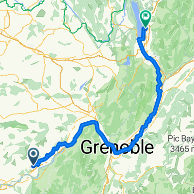
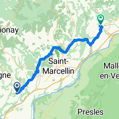
170507 vercors 9 cols
A cycling route starting in Saint-Hilaire-du-Rosier, Auvergne-Rhône-Alpes, France.
Overview
About this route
- -:--
- Duration
- 131.2 km
- Distance
- 1,999 m
- Ascent
- 2,022 m
- Descent
- ---
- Avg. speed
- ---
- Max. altitude

Route quality
Waytypes & surfaces along the route
Waytypes
Road
22.3 km
(17 %)
Quiet road
21 km
(16 %)
Surfaces
Paved
115.5 km
(88 %)
Unpaved
5.2 km
(4 %)
Asphalt
115.5 km
(88 %)
Unpaved (undefined)
3.9 km
(3 %)
Continue with Bikemap
Use, edit, or download this cycling route
You would like to ride 170507 vercors 9 cols or customize it for your own trip? Here is what you can do with this Bikemap route:
Free features
- Save this route as favorite or in collections
- Copy & plan your own version of this route
- Split it into stages to create a multi-day tour
- Sync your route with Garmin or Wahoo
Premium features
Free trial for 3 days, or one-time payment. More about Bikemap Premium.
- Navigate this route on iOS & Android
- Export a GPX / KML file of this route
- Create your custom printout (try it for free)
- Download this route for offline navigation
Discover more Premium features.
Get Bikemap PremiumFrom our community
Other popular routes starting in Saint-Hilaire-du-Rosier
 De Route du Furand 1985, Saint-Bonnet-de-Chavagne à Avenue Hippolyte Lhenry 16, Poisat
- Distance
- 64.3 km
- Ascent
- 580 m
- Descent
- 623 m
- Location
- Saint-Hilaire-du-Rosier, Auvergne-Rhône-Alpes, France
 Route du Furand nach Rue Jacotot
- Distance
- 154.4 km
- Ascent
- 903 m
- Descent
- 925 m
- Location
- Saint-Hilaire-du-Rosier, Auvergne-Rhône-Alpes, France
 2023 Agosto 4
- Distance
- 64.7 km
- Ascent
- 355 m
- Descent
- 377 m
- Location
- Saint-Hilaire-du-Rosier, Auvergne-Rhône-Alpes, France
 Valence - Nizza 19.05.2014
- Distance
- 432.4 km
- Ascent
- 4,101 m
- Descent
- 4,053 m
- Location
- Saint-Hilaire-du-Rosier, Auvergne-Rhône-Alpes, France
 Route du Furand nach Place de L Hôtel de ville
- Distance
- 23.8 km
- Ascent
- 390 m
- Descent
- 433 m
- Location
- Saint-Hilaire-du-Rosier, Auvergne-Rhône-Alpes, France
 Vercors_1: Rundtour ab Saint-Hilaire, über Route des Ecouges
- Distance
- 70.4 km
- Ascent
- 1,286 m
- Descent
- 1,296 m
- Location
- Saint-Hilaire-du-Rosier, Auvergne-Rhône-Alpes, France
 vercors
- Distance
- 153.3 km
- Ascent
- 2,965 m
- Descent
- 2,699 m
- Location
- Saint-Hilaire-du-Rosier, Auvergne-Rhône-Alpes, France
 Drome route 8
- Distance
- 140.6 km
- Ascent
- 1,517 m
- Descent
- 1,515 m
- Location
- Saint-Hilaire-du-Rosier, Auvergne-Rhône-Alpes, France
Open it in the app