

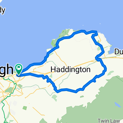
Fisherrow - Cousland - Gifford via some hills - Longyester - Pencaitland - Elphinstone - Fisherrow
A cycling route starting in Musselburgh, Scotland, United Kingdom.
Overview
About this route
mostly tarmac, some gravel paths (Pencaitland railway path)
- -:--
- Duration
- 71.2 km
- Distance
- 499 m
- Ascent
- 499 m
- Descent
- ---
- Avg. speed
- ---
- Max. altitude
Route quality
Waytypes & surfaces along the route
Waytypes
Road
24.2 km
(34 %)
Quiet road
15 km
(21 %)
Surfaces
Paved
44.2 km
(62 %)
Unpaved
4.3 km
(6 %)
Asphalt
44.2 km
(62 %)
Gravel
3.6 km
(5 %)
Continue with Bikemap
Use, edit, or download this cycling route
You would like to ride Fisherrow - Cousland - Gifford via some hills - Longyester - Pencaitland - Elphinstone - Fisherrow or customize it for your own trip? Here is what you can do with this Bikemap route:
Free features
- Save this route as favorite or in collections
- Copy & plan your own version of this route
- Sync your route with Garmin or Wahoo
Premium features
Free trial for 3 days, or one-time payment. More about Bikemap Premium.
- Navigate this route on iOS & Android
- Export a GPX / KML file of this route
- Create your custom printout (try it for free)
- Download this route for offline navigation
Discover more Premium features.
Get Bikemap PremiumFrom our community
Other popular routes starting in Musselburgh
 Gifford Belles April 2018
- Distance
- 63.6 km
- Ascent
- 388 m
- Descent
- 388 m
- Location
- Musselburgh, Scotland, United Kingdom
 Fisherow Bolton Musselburgh 301111
- Distance
- 67.4 km
- Ascent
- 456 m
- Descent
- 454 m
- Location
- Musselburgh, Scotland, United Kingdom
 Fisherrow to Tyningham
- Distance
- 94.5 km
- Ascent
- 383 m
- Descent
- 383 m
- Location
- Musselburgh, Scotland, United Kingdom
 north berwick 2nd lap
- Distance
- 67 km
- Ascent
- 163 m
- Descent
- 162 m
- Location
- Musselburgh, Scotland, United Kingdom
 This one
- Distance
- 156.7 km
- Ascent
- 1,033 m
- Descent
- 1,034 m
- Location
- Musselburgh, Scotland, United Kingdom
 carberry and tranent
- Distance
- 20.5 km
- Ascent
- 163 m
- Descent
- 163 m
- Location
- Musselburgh, Scotland, United Kingdom
 Fisherrow - Haddington & back
- Distance
- 57.3 km
- Ascent
- 232 m
- Descent
- 231 m
- Location
- Musselburgh, Scotland, United Kingdom
 Delta Road 1E to Pinkie Road 172
- Distance
- 83.9 km
- Ascent
- 672 m
- Descent
- 677 m
- Location
- Musselburgh, Scotland, United Kingdom
Open it in the app