

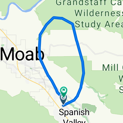
Moab to Dead Horse Point State Park
A cycling route starting in Moab, Utah, United States.
Overview
About this route
This was a really great ride in stunningly beautiful countryside. The rock formations and colors sometimes take your breath away.
Along SR191, there is excellent paved bike path while along most of SR313, there is wide shoulder. Only the last four miles to the entrance to Dead Horse Point State Park (and presumably the few miles thereafter into the Park) had no shoulder.
We highly recommend this ride. A charge of $2 per bike and rider plus two more miles of riding would have gotten us to the park visitors center...where we could have refilled our water bottles.
This leads me to recommend taking plenty of water on this ride. Along 313, there were no apparent water or other facilities available at the various look-out points until the visitors center within the park.
- -:--
- Duration
- 91.7 km
- Distance
- 941 m
- Ascent
- 938 m
- Descent
- ---
- Avg. speed
- ---
- Max. altitude

Route quality
Waytypes & surfaces along the route
Waytypes
Busy road
50.8 km
(55 %)
Cycleway
24.1 km
(26 %)
Surfaces
Paved
91.5 km
(100 %)
Asphalt
91.4 km
(100 %)
Concrete
0.1 km
(<1 %)
Undefined
0.2 km
(<1 %)
Continue with Bikemap
Use, edit, or download this cycling route
You would like to ride Moab to Dead Horse Point State Park or customize it for your own trip? Here is what you can do with this Bikemap route:
Free features
- Save this route as favorite or in collections
- Copy & plan your own version of this route
- Split it into stages to create a multi-day tour
- Sync your route with Garmin or Wahoo
Premium features
Free trial for 3 days, or one-time payment. More about Bikemap Premium.
- Navigate this route on iOS & Android
- Export a GPX / KML file of this route
- Create your custom printout (try it for free)
- Download this route for offline navigation
Discover more Premium features.
Get Bikemap PremiumFrom our community
Other popular routes starting in Moab
 Moab through Arches and Back
- Distance
- 69.8 km
- Ascent
- 1,017 m
- Descent
- 1,024 m
- Location
- Moab, Utah, United States
 Moab Gran Fondo Loop
- Distance
- 94.5 km
- Ascent
- 1,824 m
- Descent
- 1,675 m
- Location
- Moab, Utah, United States
 Moab
Moab- Distance
- 17.3 km
- Ascent
- 691 m
- Descent
- 708 m
- Location
- Moab, Utah, United States
 Moab - Runde
- Distance
- 76.8 km
- Ascent
- 1,470 m
- Descent
- 1,484 m
- Location
- Moab, Utah, United States
 USA_2016_Arches-Bryce Canyon-Las Vegas
- Distance
- 924.4 km
- Ascent
- 3,861 m
- Descent
- 4,733 m
- Location
- Moab, Utah, United States
 Salt Wash-DAV
- Distance
- 11.9 km
- Ascent
- 469 m
- Descent
- 356 m
- Location
- Moab, Utah, United States
 Portal Long Canyon Mag7 Portal
- Distance
- 72.7 km
- Ascent
- 1,754 m
- Descent
- 1,750 m
- Location
- Moab, Utah, United States
 Potash Road
- Distance
- 68.6 km
- Ascent
- 685 m
- Descent
- 688 m
- Location
- Moab, Utah, United States
Open it in the app