

Downtown Bridges / Springwater
A cycling route starting in Milwaukie, Oregon, United States.
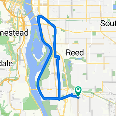
Overview
About this route
Sellwood to Steel Bridges / PDX Waterfront
- -:--
- Duration
- 20.2 km
- Distance
- 185 m
- Ascent
- 184 m
- Descent
- ---
- Avg. speed
- ---
- Max. altitude

Route quality
Waytypes & surfaces along the route
Waytypes
Path
8.5 km
(42 %)
Quiet road
3.4 km
(17 %)
Surfaces
Paved
16.6 km
(82 %)
Asphalt
6.3 km
(31 %)
Concrete
5.3 km
(26 %)
Continue with Bikemap
Use, edit, or download this cycling route
You would like to ride Downtown Bridges / Springwater or customize it for your own trip? Here is what you can do with this Bikemap route:
Free features
- Save this route as favorite or in collections
- Copy & plan your own version of this route
- Sync your route with Garmin or Wahoo
Premium features
Free trial for 3 days, or one-time payment. More about Bikemap Premium.
- Navigate this route on iOS & Android
- Export a GPX / KML file of this route
- Create your custom printout (try it for free)
- Download this route for offline navigation
Discover more Premium features.
Get Bikemap PremiumFrom our community
Other popular routes starting in Milwaukie
 October 24, 2:34 PM Springwater trail along Willamette
- Distance
- 19 km
- Ascent
- 156 m
- Descent
- 155 m
- Location
- Milwaukie, Oregon, United States
 Butterfly Park and Spring Water Corridor
- Distance
- 18 km
- Ascent
- 244 m
- Descent
- 73 m
- Location
- Milwaukie, Oregon, United States
 3117 SE Martins St, Portland to 3058 SE Woodstock Blvd, Portland
- Distance
- 18.1 km
- Ascent
- 1,318 m
- Descent
- 1,322 m
- Location
- Milwaukie, Oregon, United States
 4942 SE 28th Ave, Portland to 4952 SE 28th Ave, Portland
- Distance
- 10 km
- Ascent
- 125 m
- Descent
- 123 m
- Location
- Milwaukie, Oregon, United States
 Long way to Council Crest
- Distance
- 37.5 km
- Ascent
- 687 m
- Descent
- 650 m
- Location
- Milwaukie, Oregon, United States
 Division Loop
- Distance
- 15.7 km
- Ascent
- 165 m
- Descent
- 162 m
- Location
- Milwaukie, Oregon, United States
 Lake Oswego loop
- Distance
- 36.5 km
- Ascent
- 569 m
- Descent
- 665 m
- Location
- Milwaukie, Oregon, United States
 Route to 5675 SE International Way, Portland
- Distance
- 9.7 km
- Ascent
- 0 m
- Descent
- 8 m
- Location
- Milwaukie, Oregon, United States
Open it in the app