

Overview
About this route
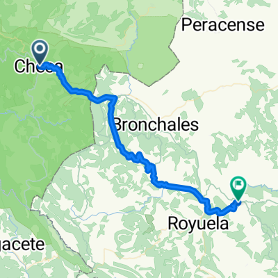
Caminos del Cid, Day 7: Checa (Guadalajara) - Albarracín (Teruel)
- -:--
- Duration
- 54 km
- Distance
- 681 m
- Ascent
- 862 m
- Descent
- ---
- Avg. speed
- ---
- Max. altitude

Part of
Zaragoza-Valencia
12 stages
Route quality
Waytypes & surfaces along the route
Waytypes
Track
2.2 km
(4 %)
Quiet road
1.1 km
(2 %)
Surfaces
Paved
0.5 km
(1 %)
Paved (undefined)
0.5 km
(1 %)
Undefined
53.4 km
(99 %)
Continue with Bikemap
Use, edit, or download this cycling route
You would like to ride Checa - Albarracín or customize it for your own trip? Here is what you can do with this Bikemap route:
Free features
- Save this route as favorite or in collections
- Copy & plan your own version of this route
- Sync your route with Garmin or Wahoo
Premium features
Free trial for 3 days, or one-time payment. More about Bikemap Premium.
- Navigate this route on iOS & Android
- Export a GPX / KML file of this route
- Create your custom printout (try it for free)
- Download this route for offline navigation
Discover more Premium features.
Get Bikemap PremiumFrom our community
Other popular routes starting in Checa
 Checa - La Cueva
- Distance
- 170 km
- Ascent
- 1,928 m
- Descent
- 1,936 m
- Location
- Checa, Castille-La Mancha, Spain
 Checa nach Escalera
- Distance
- 43.9 km
- Ascent
- 955 m
- Descent
- 1,137 m
- Location
- Checa, Castille-La Mancha, Spain
 Checa nach Calle Valhermoso Esc 4, Escalera
- Distance
- 44 km
- Ascent
- 955 m
- Descent
- 1,139 m
- Location
- Checa, Castille-La Mancha, Spain
 6-Checa-Albarracin
- Distance
- 65.2 km
- Ascent
- 565 m
- Descent
- 832 m
- Location
- Checa, Castille-La Mancha, Spain
 Dia 1 - MV
- Distance
- 66 km
- Ascent
- 1,100 m
- Descent
- 1,207 m
- Location
- Checa, Castille-La Mancha, Spain
 Checa Albarracin por Bronchales
- Distance
- 48.2 km
- Ascent
- 814 m
- Descent
- 1,005 m
- Location
- Checa, Castille-La Mancha, Spain
 Checa - Albarracín
- Distance
- 54 km
- Ascent
- 681 m
- Descent
- 862 m
- Location
- Checa, Castille-La Mancha, Spain
 Camino-del-Cid_10: Checa - Albarracín
- Distance
- 61 km
- Ascent
- 760 m
- Descent
- 945 m
- Location
- Checa, Castille-La Mancha, Spain
Open it in the app