Vercors: Five Cols, Two Gorges
A cycling route starting in Pont-en-Royans, Auvergne-Rh么ne-Alpes, France.
Overview
About this route
A quiet, scenic, loop through the Vercors with several superb cliff stretches. 聽Rarely too steep, the loop still has 2400m of ascent.聽
- -:--
- Duration
- 76.9 km
- Distance
- 2,194 m
- Ascent
- 2,194 m
- Descent
- ---
- Avg. speed
- ---
- Avg. speed
Route highlights
Points of interest along the route
Point of interest after 6 km
Col de Toutes Aures
Point of interest after 12.8 km
Col de la Croix Robert
Point of interest after 43.7 km
Col de Pr茅 Coquet
Point of interest after 46.7 km
Col du Mont Noir
Point of interest after 52.9 km
Col de Pr茅l茅tang
Continue with Bikemap
Use, edit, or download this cycling route
You would like to ride Vercors: Five Cols, Two Gorges or customize it for your own trip? Here is what you can do with this Bikemap route:
Free features
- Save this route as favorite or in collections
- Copy & plan your own version of this route
- Sync your route with Garmin or Wahoo
Premium features
Free trial for 3 days, or one-time payment. More about Bikemap Premium.
- Navigate this route on iOS & Android
- Export a GPX / KML file of this route
- Create your custom printout (try it for free)
- Download this route for offline navigation
Discover more Premium features.
Get Bikemap PremiumFrom our community
Other popular routes starting in Pont-en-Royans
- Gorges Bournes 83km-1800m
- Distance
- 83.7 km
- Ascent
- 1,577 m
- Descent
- 1,581 m
- Location
- Pont-en-Royans, Auvergne-Rh么ne-Alpes, France
- Combe Laval- Col de la Bataille
- Distance
- 118.4 km
- Ascent
- 4,153 m
- Descent
- 4,154 m
- Location
- Pont-en-Royans, Auvergne-Rh么ne-Alpes, France
- Vercors: Combe Laval
- Distance
- 56.6 km
- Ascent
- 1,186 m
- Descent
- 1,185 m
- Location
- Pont-en-Royans, Auvergne-Rh么ne-Alpes, France
- Vercors par Pont sans Villard
- Distance
- 94.5 km
- Ascent
- 1,784 m
- Descent
- 1,784 m
- Location
- Pont-en-Royans, Auvergne-Rh么ne-Alpes, France
- Sud de Vercors
- Distance
- 123.8 km
- Ascent
- 2,596 m
- Descent
- 2,596 m
- Location
- Pont-en-Royans, Auvergne-Rh么ne-Alpes, France
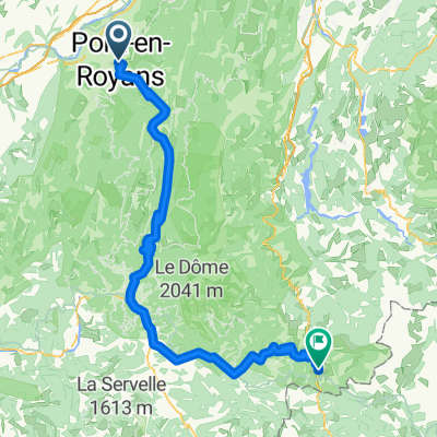
- quaeldich Route 3 50km
- Distance
- 23.5 km
- Ascent
- 1,703 m
- Descent
- 940 m
- Location
- Pont-en-Royans, Auvergne-Rh么ne-Alpes, France
- 2016 Ride Day 152 - Pont-en-Royans to Valence
- Distance
- 67.2 km
- Ascent
- 984 m
- Descent
- 1,074 m
- Location
- Pont-en-Royans, Auvergne-Rh么ne-Alpes, France
- 3 猫me 茅tape Summer Ride
- Distance
- 103.8 km
- Ascent
- 2,026 m
- Descent
- 1,219 m
- Location
- Pont-en-Royans, Auvergne-Rh么ne-Alpes, France
Open it in the app