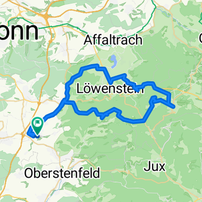
Runde um Burg Wildeck (Abstatt)
- 20 km
- 268 m
- 268 m
- Abstatt, Baden-Wurttemberg, Germany
Heilbronner Wald
A cycling route starting in Abstatt, Baden-Wurttemberg, Germany.
Overview
Stettenfels
Schweinsberg
DAV
Schanzenweg
Gaffenberg
Köpferthal
Waldheide
Wurzelweg
Galgenberg
Paradiesweg
Reisberg
Grenzweg
Stettenfels
created this 8 years ago
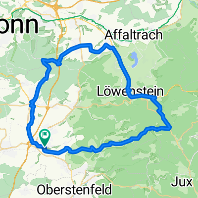
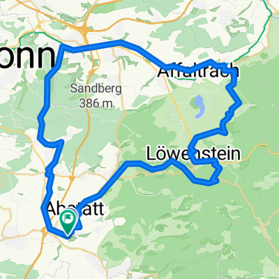
Part of
3 stages
Route quality
Track
22.5 km
(54 %)
Path
15 km
(36 %)
Paved
12.5 km
(30 %)
Unpaved
27 km
(65 %)
Ground
12.5 km
(30 %)
Asphalt
10 km
(24 %)
Continue with Bikemap
You would like to ride Schweinsbergrunde-Stage3_42km-800hm or customize it for your own trip? Here is what you can do with this Bikemap route:
Free trial for 3 days, or one-time payment. More about Bikemap Premium.
Discover more Premium features.
Get Bikemap PremiumFrom our community
Open it in the app