

RR - rund um Rax/Schneealpe
A cycling route starting in Leobersdorf, Lower Austria, Austria.
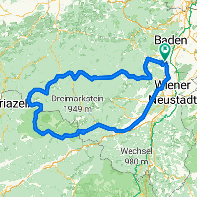
Overview
About this route
Leobersdorf (parking near Mc Donalds) Bad Fischau - Neunkirchen - Gloggnitz - Preiner Gscheid - Mürzsteg - Lahnsattel - Gscheid - Ochssattel - Leobersdorf (parking near Mc Donalds)
- -:--
- Duration
- 207.8 km
- Distance
- 1,940 m
- Ascent
- 1,716 m
- Descent
- ---
- Avg. speed
- 1,084 m
- Max. altitude
Route quality
Waytypes & surfaces along the route
Waytypes
Quiet road
43.6 km
(21 %)
Path
16.6 km
(8 %)
Surfaces
Paved
108.1 km
(52 %)
Unpaved
10.4 km
(5 %)
Asphalt
106 km
(51 %)
Unpaved (undefined)
4.2 km
(2 %)
Continue with Bikemap
Use, edit, or download this cycling route
You would like to ride RR - rund um Rax/Schneealpe or customize it for your own trip? Here is what you can do with this Bikemap route:
Free features
- Save this route as favorite or in collections
- Copy & plan your own version of this route
- Split it into stages to create a multi-day tour
- Sync your route with Garmin or Wahoo
Premium features
Free trial for 3 days, or one-time payment. More about Bikemap Premium.
- Navigate this route on iOS & Android
- Export a GPX / KML file of this route
- Create your custom printout (try it for free)
- Download this route for offline navigation
Discover more Premium features.
Get Bikemap PremiumFrom our community
Other popular routes starting in Leobersdorf
 Von Leobersdorf bis Hainfeld
- Distance
- 47.9 km
- Ascent
- 1,048 m
- Descent
- 881 m
- Location
- Leobersdorf, Lower Austria, Austria
 RR - rund um Rax/Schneealpe
- Distance
- 207.8 km
- Ascent
- 1,940 m
- Descent
- 1,716 m
- Location
- Leobersdorf, Lower Austria, Austria
 Großauer Höhe
- Distance
- 26 km
- Ascent
- 239 m
- Descent
- 239 m
- Location
- Leobersdorf, Lower Austria, Austria
 Leobersdorf - Hainfeld - Tulln - Wien - Leobersdorf
- Distance
- 220.1 km
- Ascent
- 1,287 m
- Descent
- 1,287 m
- Location
- Leobersdorf, Lower Austria, Austria
 Von Leobersdorf bis Hainfeld
- Distance
- 47.9 km
- Ascent
- 1,048 m
- Descent
- 881 m
- Location
- Leobersdorf, Lower Austria, Austria
 Thermenregio zur Rosalia 01
- Distance
- 76.7 km
- Ascent
- 817 m
- Descent
- 810 m
- Location
- Leobersdorf, Lower Austria, Austria
 Tour zum Neusiedlersee
- Distance
- 113.1 km
- Ascent
- 524 m
- Descent
- 524 m
- Location
- Leobersdorf, Lower Austria, Austria
 Rund um Leobersdorf
- Distance
- 36.3 km
- Ascent
- 261 m
- Descent
- 262 m
- Location
- Leobersdorf, Lower Austria, Austria
Open it in the app