Čavle-Kamenjak-Škrljevo-Sv.Kuzam-Čavle_ZK
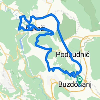
- 35.6 km
- 877 m
- 877 m
- Čavle, Primorje-Gorski Kotar County, Croatia
A cycling route starting in Čavle, Primorje-Gorski Kotar County, Croatia.
Overview
Vojak-Martinovo selo-Čavle-Mavrinci-Kukuljanovo-Draga-Vojak
created this 8 years ago
Route quality
Road
11.6 km
(37 %)
Quiet road
3.4 km
(11 %)
Paved
16.6 km
(53 %)
Asphalt
16.6 km
(53 %)
Undefined
14.7 km
(47 %)
Route highlights
voznjica
vojak-martinovo selo-cavle-mavrinci-kukuljanovo-draga-vojak
Continue with Bikemap
You would like to ride Vožnjica or customize it for your own trip? Here is what you can do with this Bikemap route:
Free trial for 3 days, or one-time payment. More about Bikemap Premium.
Discover more Premium features.
Get Bikemap PremiumFrom our community
Open it in the app