

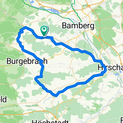
Kapellenweg
A cycling route starting in Walsdorf, Bavaria, Germany.
Overview
About this route
From Oberharnsbach, there is a beautiful path to the chapel, easy distance of about 2 km
- -:--
- Duration
- 2 km
- Distance
- 0 m
- Ascent
- 43 m
- Descent
- ---
- Avg. speed
- 311 m
- Max. altitude
Route quality
Waytypes & surfaces along the route
Waytypes
Track
1.8 km
(92 %)
Quiet road
0.2 km
(8 %)
Surfaces
Paved
1 km
(51 %)
Unpaved
1 km
(49 %)
Gravel
1 km
(49 %)
Paved (undefined)
0.9 km
(43 %)
Asphalt
0.2 km
(8 %)
Route highlights
Points of interest along the route
Point of interest after 0 km
Kapelle Maria Patrona Bavaria
Point of interest after 1.1 km
Brauerei Kaiser
Point of interest after 2 km
Gasthaus Dellermann Oberharnsbach
Continue with Bikemap
Use, edit, or download this cycling route
You would like to ride Kapellenweg or customize it for your own trip? Here is what you can do with this Bikemap route:
Free features
- Save this route as favorite or in collections
- Copy & plan your own version of this route
- Sync your route with Garmin or Wahoo
Premium features
Free trial for 3 days, or one-time payment. More about Bikemap Premium.
- Navigate this route on iOS & Android
- Export a GPX / KML file of this route
- Create your custom printout (try it for free)
- Download this route for offline navigation
Discover more Premium features.
Get Bikemap PremiumFrom our community
Other popular routes starting in Walsdorf
 Schulstraße, Walsdorf to Schulstraße, Walsdorf
- Distance
- 47.9 km
- Ascent
- 579 m
- Descent
- 577 m
- Location
- Walsdorf, Bavaria, Germany
 Schulstraße, Walsdorf to Schulstraße, Walsdorf
- Distance
- 57.3 km
- Ascent
- 435 m
- Descent
- 437 m
- Location
- Walsdorf, Bavaria, Germany
 Schulstraße, Walsdorf to Schulstraße, Walsdorf
- Distance
- 56 km
- Ascent
- 356 m
- Descent
- 357 m
- Location
- Walsdorf, Bavaria, Germany
 Schulstraße, Walsdorf to Schulstraße, Walsdorf
- Distance
- 36.1 km
- Ascent
- 227 m
- Descent
- 229 m
- Location
- Walsdorf, Bavaria, Germany
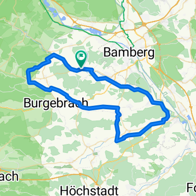
 Trainigsstrecke 2 Dankenfeld/Burgebrach
- Distance
- 45.2 km
- Ascent
- 312 m
- Descent
- 330 m
- Location
- Walsdorf, Bavaria, Germany
 Steigerwaldroute1Schönbrunn/Knetzgau/Trosdorf
- Distance
- 70.3 km
- Ascent
- 780 m
- Descent
- 773 m
- Location
- Walsdorf, Bavaria, Germany
 Kapellenweg
- Distance
- 2 km
- Ascent
- 0 m
- Descent
- 43 m
- Location
- Walsdorf, Bavaria, Germany
 Steigerwaldroute 3Schönbrunn/Eltmann/Viereth
- Distance
- 56.6 km
- Ascent
- 672 m
- Descent
- 687 m
- Location
- Walsdorf, Bavaria, Germany
Open it in the app