

Międzybórz i dach Wielkopolski
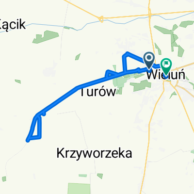
A cycling route starting in Wieluń, Łódź Voivodeship, Poland.
Overview
About this route
A 'time trial' route, meaning from the train I got off at 8:30 to the train I had on the platform at 18:36 in Kluczbork.
- -:--
- Duration
- 173.2 km
- Distance
- ---
- Ascent
- ---
- Descent
- ---
- Avg. speed
- ---
- Max. altitude

Route quality
Waytypes & surfaces along the route
Waytypes
Road
69.3 km
(40 %)
Quiet road
57.2 km
(33 %)
Surfaces
Paved
110.8 km
(64 %)
Unpaved
5.2 km
(3 %)
Asphalt
109.1 km
(63 %)
Paved (undefined)
1.7 km
(1 %)
Continue with Bikemap
Use, edit, or download this cycling route
You would like to ride Międzybórz i dach Wielkopolski or customize it for your own trip? Here is what you can do with this Bikemap route:
Free features
- Save this route as favorite or in collections
- Copy & plan your own version of this route
- Split it into stages to create a multi-day tour
- Sync your route with Garmin or Wahoo
Premium features
Free trial for 3 days, or one-time payment. More about Bikemap Premium.
- Navigate this route on iOS & Android
- Export a GPX / KML file of this route
- Create your custom printout (try it for free)
- Download this route for offline navigation
Discover more Premium features.
Get Bikemap PremiumFrom our community
Other popular routes starting in Wieluń
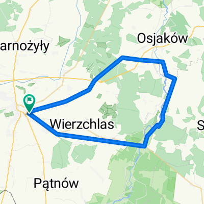
 Wielkopolski klasyk
- Distance
- 386.7 km
- Ascent
- 260 m
- Descent
- 368 m
- Location
- Wieluń, Łódź Voivodeship, Poland
 Strugi
- Distance
- 25.5 km
- Ascent
- 199 m
- Descent
- 212 m
- Location
- Wieluń, Łódź Voivodeship, Poland
 Graniczna 20A, Wieluń do Joanny Żubr 23, Wieluń
- Distance
- 20.6 km
- Ascent
- 62 m
- Descent
- 78 m
- Location
- Wieluń, Łódź Voivodeship, Poland
 Wielun-Skomlin-Lyskornia-Lagiewniki-Wielun
- Distance
- 52.5 km
- Ascent
- 78 m
- Descent
- 76 m
- Location
- Wieluń, Łódź Voivodeship, Poland
 Starzenice,Knieja,Toporów,Kurhany w Przywozie i na Strugach,Bieniec,Pątnów,Strugi,Przycłapy
- Distance
- 60.3 km
- Ascent
- 176 m
- Descent
- 176 m
- Location
- Wieluń, Łódź Voivodeship, Poland
 2 x pętla Pątnów Kluski Bieniec (+ Wieluń)
- Distance
- 69.5 km
- Ascent
- 281 m
- Descent
- 281 m
- Location
- Wieluń, Łódź Voivodeship, Poland
 Młodzieżowa 5, Wieluń do Henryka Sienkiewicza 1, Wieluń
- Distance
- 20 km
- Ascent
- 79 m
- Descent
- 74 m
- Location
- Wieluń, Łódź Voivodeship, Poland
 Felinów
- Distance
- 41.2 km
- Ascent
- 132 m
- Descent
- 132 m
- Location
- Wieluń, Łódź Voivodeship, Poland
Open it in the app