

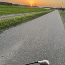
Katzenbuckel - Wilhelmsfeld - Königstuhl
A cycling route starting in Reilingen, Baden-Wurttemberg, Germany.
Overview
About this route
- -:--
- Duration
- 161.9 km
- Distance
- 3,317 m
- Ascent
- 3,182 m
- Descent
- ---
- Avg. speed
- 508 m
- Max. altitude
Route quality
Waytypes & surfaces along the route
Waytypes
Road
51.8 km
(32 %)
Track
16.2 km
(10 %)
Surfaces
Paved
132.8 km
(82 %)
Unpaved
8.1 km
(5 %)
Asphalt
129.5 km
(80 %)
Gravel
6.5 km
(4 %)
Continue with Bikemap
Use, edit, or download this cycling route
You would like to ride Katzenbuckel - Wilhelmsfeld - Königstuhl or customize it for your own trip? Here is what you can do with this Bikemap route:
Free features
- Save this route as favorite or in collections
- Copy & plan your own version of this route
- Split it into stages to create a multi-day tour
- Sync your route with Garmin or Wahoo
Premium features
Free trial for 3 days, or one-time payment. More about Bikemap Premium.
- Navigate this route on iOS & Android
- Export a GPX / KML file of this route
- Create your custom printout (try it for free)
- Download this route for offline navigation
Discover more Premium features.
Get Bikemap PremiumFrom our community
Other popular routes starting in Reilingen
 Dresdener Straße, Reilingen nach Dresdener Straße, Reilingen
- Distance
- 22.7 km
- Ascent
- 26 m
- Descent
- 25 m
- Location
- Reilingen, Baden-Wurttemberg, Germany
 Reilingen Speyer Karlsruhe
- Distance
- 76.5 km
- Ascent
- 71 m
- Descent
- 59 m
- Location
- Reilingen, Baden-Wurttemberg, Germany
 Kleine Kraichgaurunde
- Distance
- 50.8 km
- Ascent
- 302 m
- Descent
- 290 m
- Location
- Reilingen, Baden-Wurttemberg, Germany
 Mannheimer Reilingen-Mannheim leichte Route
- Distance
- 25.1 km
- Ascent
- 22 m
- Descent
- 30 m
- Location
- Reilingen, Baden-Wurttemberg, Germany
 Wags - Phils - Wies - Sts - Reil
- Distance
- 36.5 km
- Ascent
- 49 m
- Descent
- 50 m
- Location
- Reilingen, Baden-Wurttemberg, Germany
 Reilingen Speyer Karlsruhe
- Distance
- 76.5 km
- Ascent
- 69 m
- Descent
- 58 m
- Location
- Reilingen, Baden-Wurttemberg, Germany
 Round-trip Reilingen > Rheinhausen > Oberhausen >Reilingen
- Distance
- 24.1 km
- Ascent
- 42 m
- Descent
- 41 m
- Location
- Reilingen, Baden-Wurttemberg, Germany
 Altußheim- Speyer -Altlußheim CLONED FROM ROUTE 70717
- Distance
- 36 km
- Ascent
- 93 m
- Descent
- 92 m
- Location
- Reilingen, Baden-Wurttemberg, Germany
Open it in the app