

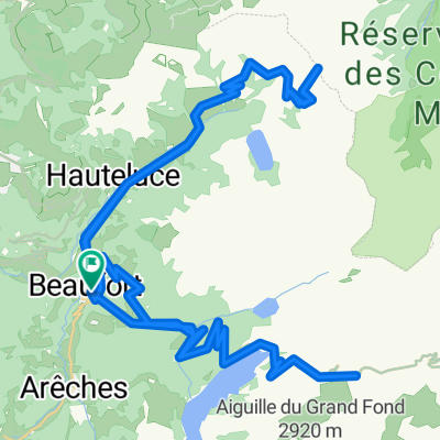
Areches to Courmayer 95K 2850M
A cycling route starting in Beaufort, Auvergne-Rhône-Alpes, France.
Overview
About this route
Areches-Beaufort to the Tunnel Courmayer Hello Alps
- -:--
- Duration
- 94 km
- Distance
- 2,726 m
- Ascent
- 2,507 m
- Descent
- ---
- Avg. speed
- ---
- Max. altitude

Route quality
Waytypes & surfaces along the route
Waytypes
Road
16.9 km
(18 %)
Quiet road
12.2 km
(13 %)
Surfaces
Paved
67.7 km
(72 %)
Unpaved
1.9 km
(2 %)
Asphalt
67.7 km
(72 %)
Unpaved (undefined)
0.9 km
(1 %)
Continue with Bikemap
Use, edit, or download this cycling route
You would like to ride Areches to Courmayer 95K 2850M or customize it for your own trip? Here is what you can do with this Bikemap route:
Free features
- Save this route as favorite or in collections
- Copy & plan your own version of this route
- Split it into stages to create a multi-day tour
- Sync your route with Garmin or Wahoo
Premium features
Free trial for 3 days, or one-time payment. More about Bikemap Premium.
- Navigate this route on iOS & Android
- Export a GPX / KML file of this route
- Create your custom printout (try it for free)
- Download this route for offline navigation
Discover more Premium features.
Get Bikemap PremiumFrom our community
Other popular routes starting in Beaufort
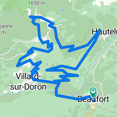
 Day 2 - Col Du Joly, Cormet de Roselend
- Distance
- 81.7 km
- Ascent
- 3,903 m
- Descent
- 3,903 m
- Location
- Beaufort, Auvergne-Rhône-Alpes, France
 Beaufort - Le Grand-Bornand
- Distance
- 53.8 km
- Ascent
- 1,406 m
- Descent
- 1,075 m
- Location
- Beaufort, Auvergne-Rhône-Alpes, France
 Beaufort - Moûtiers + Moûtiers - Courchevel 1850
- Distance
- 103.5 km
- Ascent
- 4,826 m
- Descent
- 3,269 m
- Location
- Beaufort, Auvergne-Rhône-Alpes, France
 Cormet d'Areches and Col du Pré
- Distance
- 54.7 km
- Ascent
- 1,964 m
- Descent
- 1,964 m
- Location
- Beaufort, Auvergne-Rhône-Alpes, France
 Areches to Courmayer 95K 2850M
- Distance
- 94 km
- Ascent
- 2,726 m
- Descent
- 2,507 m
- Location
- Beaufort, Auvergne-Rhône-Alpes, France
 Day 3 - OPTIONAL Col des Saisies
- Distance
- 35.8 km
- Ascent
- 1,513 m
- Descent
- 1,513 m
- Location
- Beaufort, Auvergne-Rhône-Alpes, France
 (08) Beaufort - Bourg-St.Maurice
- Distance
- 43.4 km
- Ascent
- 1,330 m
- Descent
- 1,197 m
- Location
- Beaufort, Auvergne-Rhône-Alpes, France
 col de la forclaz, col de aspartaz; col des saisies par crest voland
- Distance
- 84 km
- Ascent
- 2,376 m
- Descent
- 2,376 m
- Location
- Beaufort, Auvergne-Rhône-Alpes, France
Open it in the app