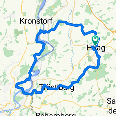
Mostviertelrunde
A cycling route starting in Haag, Lower Austria, Austria.
Overview
About this route
Von Vestenthal-Haag Tierpark-Weistrach-St.Peter/Au-St.Michael/Bruckbach-Kürnberg-St.Peter/Au-Seitenstetten-Wolfsbach-Strengberg-Haag-'Vestenthal
- -:--
- Duration
- 76.9 km
- Distance
- 1,282 m
- Ascent
- 1,268 m
- Descent
- ---
- Avg. speed
- 701 m
- Avg. speed
Route quality
Waytypes & surfaces along the route
Waytypes
Busy road
47.5 km
(62 %)
Road
18.7 km
(24 %)
Surfaces
Paved
44.3 km
(58 %)
Unpaved
0.2 km
(<1 %)
Asphalt
44.3 km
(58 %)
Unpaved (undefined)
0.2 km
(<1 %)
Continue with Bikemap
Use, edit, or download this cycling route
You would like to ride Mostviertelrunde or customize it for your own trip? Here is what you can do with this Bikemap route:
Free features
- Save this route as favorite or in collections
- Copy & plan your own version of this route
- Sync your route with Garmin or Wahoo
Premium features
Free trial for 3 days, or one-time payment. More about Bikemap Premium.
- Navigate this route on iOS & Android
- Export a GPX / KML file of this route
- Create your custom printout (try it for free)
- Download this route for offline navigation
Discover more Premium features.
Get Bikemap PremiumFrom our community
Other popular routes starting in Haag
- Haag Walking 1
- Distance
- 5.2 km
- Ascent
- 67 m
- Descent
- 60 m
- Location
- Haag, Lower Austria, Austria
- Mostviertelrunde
- Distance
- 76.9 km
- Ascent
- 1,282 m
- Descent
- 1,268 m
- Location
- Haag, Lower Austria, Austria
- Stadt Haag
- Distance
- 42.8 km
- Ascent
- 287 m
- Descent
- 256 m
- Location
- Haag, Lower Austria, Austria
- 2019_MW_Haag, Amstetten
- Distance
- 59.7 km
- Ascent
- 425 m
- Descent
- 422 m
- Location
- Haag, Lower Austria, Austria
- Haag-Wien
- Distance
- 164.6 km
- Ascent
- 393 m
- Descent
- 498 m
- Location
- Haag, Lower Austria, Austria
- Haag Walking 2
- Distance
- 4.1 km
- Ascent
- 62 m
- Descent
- 62 m
- Location
- Haag, Lower Austria, Austria
- amstetten
- Distance
- 96.1 km
- Ascent
- 841 m
- Descent
- 844 m
- Location
- Haag, Lower Austria, Austria
- Mostviertelrunde inkl. Panorama Höhenstraße
- Distance
- 97.7 km
- Ascent
- 1,028 m
- Descent
- 1,029 m
- Location
- Haag, Lower Austria, Austria
Open it in the app