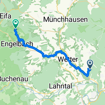
2017 Trainingsrunde Wetter
A cycling route starting in Wetter, Hesse, Germany.
Overview
About this route
n Trainingsstunde mit paar Höhenmetern
- -:--
- Duration
- 20.1 km
- Distance
- 234 m
- Ascent
- 225 m
- Descent
- ---
- Avg. speed
- ---
- Max. altitude
Route quality
Waytypes & surfaces along the route
Waytypes
Quiet road
7.2 km
(36 %)
Road
6.5 km
(32 %)
Surfaces
Paved
14 km
(69 %)
Asphalt
13.5 km
(67 %)
Paved (undefined)
0.4 km
(2 %)
Continue with Bikemap
Use, edit, or download this cycling route
You would like to ride 2017 Trainingsrunde Wetter or customize it for your own trip? Here is what you can do with this Bikemap route:
Free features
- Save this route as favorite or in collections
- Copy & plan your own version of this route
- Sync your route with Garmin or Wahoo
Premium features
Free trial for 3 days, or one-time payment. More about Bikemap Premium.
- Navigate this route on iOS & Android
- Export a GPX / KML file of this route
- Create your custom printout (try it for free)
- Download this route for offline navigation
Discover more Premium features.
Get Bikemap PremiumFrom our community
Other popular routes starting in Wetter
- 2014 Burgwaldrunde
- Distance
- 19.4 km
- Ascent
- 309 m
- Descent
- 309 m
- Location
- Wetter, Hesse, Germany
- 2014 Burgwald-Schönstadt Tour
- Distance
- 24.6 km
- Ascent
- 502 m
- Descent
- 505 m
- Location
- Wetter, Hesse, Germany
- Zu den Quellen von Lahn, Sieg und Eder
- Distance
- 115.3 km
- Ascent
- 1,445 m
- Descent
- 1,445 m
- Location
- Wetter, Hesse, Germany
- Treisbach-Sackpfeife-Treisbach (MTB)
- Distance
- 28.8 km
- Ascent
- 591 m
- Descent
- 591 m
- Location
- Wetter, Hesse, Germany
- Durch das Hinterland
- Distance
- 82.5 km
- Ascent
- 593 m
- Descent
- 592 m
- Location
- Wetter, Hesse, Germany
- 1993/2007 Herborn Sb.-Aartalsee-Mr
- Distance
- 56 km
- Ascent
- 349 m
- Descent
- 319 m
- Location
- Wetter, Hesse, Germany
- 2017 Amöneburgblick Runde
- Distance
- 29.1 km
- Ascent
- 429 m
- Descent
- 430 m
- Location
- Wetter, Hesse, Germany
- 2009 Urosphe--Bicken via Schelder Wald
- Distance
- 51.5 km
- Ascent
- 498 m
- Descent
- 463 m
- Location
- Wetter, Hesse, Germany
Open it in the app