

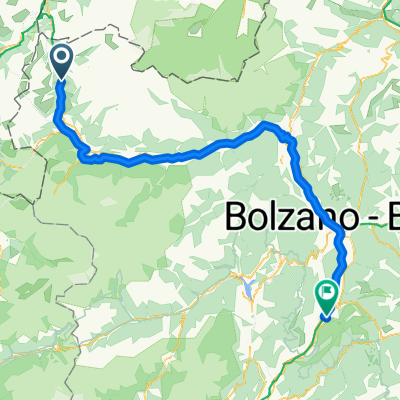
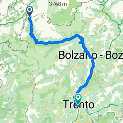
vom Reschen nach Bozen
A cycling route starting in Graun im Vinschgau, Trentino-Alto Adige, Italy.
Overview
About this route
We started in Reschen, along the shore to Lake Haider. Passing Burgeis, Glurns, with a detour to Schlanders. Continuing through Naturns, Marling to Bolzano. Back with the Vinschgerbahn to Mals and bus to Reschen.
- -:--
- Duration
- 120.7 km
- Distance
- 172 m
- Ascent
- 1,416 m
- Descent
- ---
- Avg. speed
- ---
- Max. altitude

Continue with Bikemap
Use, edit, or download this cycling route
You would like to ride vom Reschen nach Bozen or customize it for your own trip? Here is what you can do with this Bikemap route:
Free features
- Save this route as favorite or in collections
- Copy & plan your own version of this route
- Split it into stages to create a multi-day tour
- Sync your route with Garmin or Wahoo
Premium features
Free trial for 3 days, or one-time payment. More about Bikemap Premium.
- Navigate this route on iOS & Android
- Export a GPX / KML file of this route
- Create your custom printout (try it for free)
- Download this route for offline navigation
Discover more Premium features.
Get Bikemap PremiumFrom our community
Other popular routes starting in Graun im Vinschgau
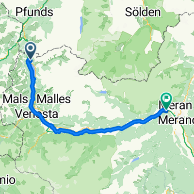 Reschen - Meran
- Distance
- 73.2 km
- Ascent
- 619 m
- Descent
- 1,744 m
- Location
- Graun im Vinschgau, Trentino-Alto Adige, Italy
 Umrundung Reschensee und Heidersee
- Distance
- 24.9 km
- Ascent
- 234 m
- Descent
- 229 m
- Location
- Graun im Vinschgau, Trentino-Alto Adige, Italy
 Schlanders - San Michele all'Adige
- Distance
- 119.7 km
- Ascent
- 566 m
- Descent
- 1,812 m
- Location
- Graun im Vinschgau, Trentino-Alto Adige, Italy
 Tag 5: Bergab durch Südtirol
- Distance
- 122.6 km
- Ascent
- 310 m
- Descent
- 1,609 m
- Location
- Graun im Vinschgau, Trentino-Alto Adige, Italy
 leg 2 final
- Distance
- 196.3 km
- Ascent
- 1,074 m
- Descent
- 2,384 m
- Location
- Graun im Vinschgau, Trentino-Alto Adige, Italy
 Zwölfer am 9.4.20
- Distance
- 7.3 km
- Ascent
- 895 m
- Descent
- 884 m
- Location
- Graun im Vinschgau, Trentino-Alto Adige, Italy
 Reschensee Nauders
- Distance
- 36.9 km
- Ascent
- 530 m
- Descent
- 527 m
- Location
- Graun im Vinschgau, Trentino-Alto Adige, Italy
 Via Paese Vecchio - Waldbodenweg
- Distance
- 18.3 km
- Ascent
- 125 m
- Descent
- 137 m
- Location
- Graun im Vinschgau, Trentino-Alto Adige, Italy
Open it in the app