

20170521_155214.gpx
A cycling route starting in Französisch Buchholz, State of Berlin, Germany.
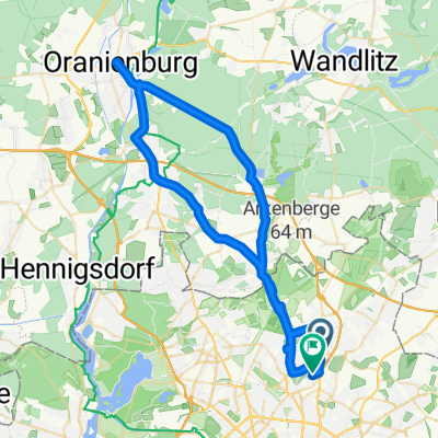
Overview
About this route
TAHUNA track
- -:--
- Duration
- 24.7 km
- Distance
- 64 m
- Ascent
- 69 m
- Descent
- ---
- Avg. speed
- ---
- Max. altitude

Route quality
Waytypes & surfaces along the route
Waytypes
Path
5.4 km
(22 %)
Quiet road
5.2 km
(21 %)
Surfaces
Paved
13.6 km
(55 %)
Unpaved
7.9 km
(32 %)
Asphalt
13.1 km
(53 %)
Loose gravel
4.9 km
(20 %)
Route highlights
Points of interest along the route
Point of interest after 12.7 km
Am Gorinsee
Continue with Bikemap
Use, edit, or download this cycling route
You would like to ride 20170521_155214.gpx or customize it for your own trip? Here is what you can do with this Bikemap route:
Free features
- Save this route as favorite or in collections
- Copy & plan your own version of this route
- Sync your route with Garmin or Wahoo
Premium features
Free trial for 3 days, or one-time payment. More about Bikemap Premium.
- Navigate this route on iOS & Android
- Export a GPX / KML file of this route
- Create your custom printout (try it for free)
- Download this route for offline navigation
Discover more Premium features.
Get Bikemap PremiumFrom our community
Other popular routes starting in Französisch Buchholz
 Nordberliner 70 km Runde
- Distance
- 67.7 km
- Ascent
- 108 m
- Descent
- 105 m
- Location
- Französisch Buchholz, State of Berlin, Germany
 Berlin Pankow-Werbelinsee Runde 1.6.09
- Distance
- 114.7 km
- Ascent
- 373 m
- Descent
- 368 m
- Location
- Französisch Buchholz, State of Berlin, Germany
 Galenusstr. - Oranienburg - Galenusstr.
- Distance
- 64 km
- Ascent
- 102 m
- Descent
- 100 m
- Location
- Französisch Buchholz, State of Berlin, Germany
 Quick race bike tour in the north of Berlin
- Distance
- 43.2 km
- Ascent
- 74 m
- Descent
- 74 m
- Location
- Französisch Buchholz, State of Berlin, Germany
 Pankow-Buch-Pankow
- Distance
- 31.7 km
- Ascent
- 55 m
- Descent
- 55 m
- Location
- Französisch Buchholz, State of Berlin, Germany
 Schönerlinder Straße
- Distance
- 3.5 km
- Ascent
- 8 m
- Descent
- 9 m
- Location
- Französisch Buchholz, State of Berlin, Germany
 Pankow Wandlitz Rundkurs
- Distance
- 61.1 km
- Ascent
- 114 m
- Descent
- 114 m
- Location
- Französisch Buchholz, State of Berlin, Germany
 Pankow-Buch-Pankow
- Distance
- 30.2 km
- Ascent
- 33 m
- Descent
- 33 m
- Location
- Französisch Buchholz, State of Berlin, Germany
Open it in the app