

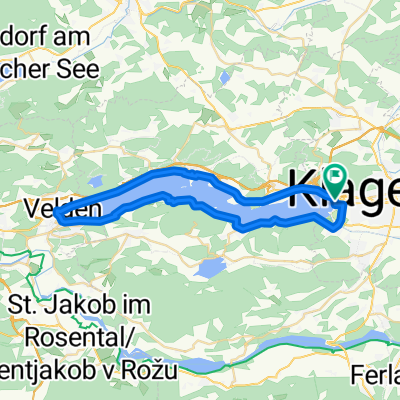
🚴♀️E*Bike🇦🇹 17.05.21. 5.Tag Wörthersee
A cycling route starting in Klagenfurt, Carinthia, Austria.
Overview
About this route
Wegbeschreibung: Wörthersee Radwanderung.
Klagenfurt Strandbad bis zum Vogelschutzgebiet Schilfweg 46.610148, 14.254654
Pötschach Landspitze, Blumeninsel 470m x 95 m Landschaftsschutzgebiet 46.629068, 14.142773
Peter Alexander Steg 46.628333, 14.143770
Velden Bäckerteich 46.609190, 14.037315
- -:--
- Duration
- 22.7 km
- Distance
- 74 m
- Ascent
- 57 m
- Descent
- ---
- Avg. speed
- ---
- Max. altitude

Route photos


Route quality
Waytypes & surfaces along the route
Waytypes
Cycleway
10.4 km
(46 %)
Quiet road
7.5 km
(33 %)
Surfaces
Paved
19.3 km
(85 %)
Unpaved
0.2 km
(1 %)
Asphalt
19.3 km
(85 %)
Gravel
0.2 km
(1 %)
Undefined
3.2 km
(14 %)
Continue with Bikemap
Use, edit, or download this cycling route
You would like to ride 🚴♀️E*Bike🇦🇹 17.05.21. 5.Tag Wörthersee or customize it for your own trip? Here is what you can do with this Bikemap route:
Free features
- Save this route as favorite or in collections
- Copy & plan your own version of this route
- Sync your route with Garmin or Wahoo
Premium features
Free trial for 3 days, or one-time payment. More about Bikemap Premium.
- Navigate this route on iOS & Android
- Export a GPX / KML file of this route
- Create your custom printout (try it for free)
- Download this route for offline navigation
Discover more Premium features.
Get Bikemap PremiumFrom our community
Other popular routes starting in Klagenfurt
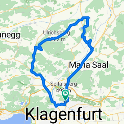
 Klagenfurt Nord- Dürnstein
- Distance
- 34 km
- Ascent
- 234 m
- Descent
- 92 m
- Location
- Klagenfurt, Carinthia, Austria
 Unterkärnten extreme
- Distance
- 127.9 km
- Ascent
- 2,804 m
- Descent
- 2,780 m
- Location
- Klagenfurt, Carinthia, Austria
 Wörthersee-Süduferstraße 55A, Klagenfurt am Wörthersee to Wörthersee-Süduferstraße 55A, Klagenfurt am Wörthersee
- Distance
- 45.1 km
- Ascent
- 306 m
- Descent
- 340 m
- Location
- Klagenfurt, Carinthia, Austria
 WörtherseeTrail - Moutianbike
- Distance
- 58.9 km
- Ascent
- 1,279 m
- Descent
- 1,277 m
- Location
- Klagenfurt, Carinthia, Austria
 Hörzendorf Runde
- Distance
- 34.8 km
- Ascent
- 536 m
- Descent
- 542 m
- Location
- Klagenfurt, Carinthia, Austria
 Klagenfurt I
- Distance
- 29.4 km
- Ascent
- 65 m
- Descent
- 61 m
- Location
- Klagenfurt, Carinthia, Austria
 Ostersonntag
- Distance
- 75.2 km
- Ascent
- 388 m
- Descent
- 389 m
- Location
- Klagenfurt, Carinthia, Austria
 Wörthersee roundtour
- Distance
- 40.5 km
- Ascent
- 515 m
- Descent
- 516 m
- Location
- Klagenfurt, Carinthia, Austria
Open it in the app