

Tour de Bałkany 2017 dzień 2
A cycling route starting in Dunajská Lužná, Bratislava Region, Slovakia.
Overview
About this route
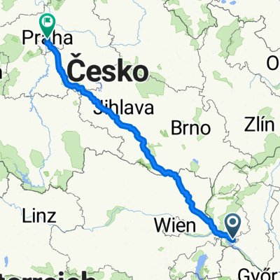
Dunajskie Ostrovy – Cunovo – (granica słowacko-węgierska) – Rajka (150) – Bezeney – MOSONMAGYAROVAR (1) – Otteveny - Abda – GYOR (82) – Nyul – Pannonhalma (Arany Janous) – Ravazd (82) – Bakonpeterd – Veszpremvarsany – Bakonyszentkiraly – Zirc – Epleny – Gyulafiratot – Kadarta – VESZPREM (Budapest Ut-E66-72) – Liter – Balatonfuzfo (przy Balatonie)
- -:--
- Duration
- 167.9 km
- Distance
- 523 m
- Ascent
- 541 m
- Descent
- ---
- Avg. speed
- ---
- Max. altitude

Continue with Bikemap
Use, edit, or download this cycling route
You would like to ride Tour de Bałkany 2017 dzień 2 or customize it for your own trip? Here is what you can do with this Bikemap route:
Free features
- Save this route as favorite or in collections
- Copy & plan your own version of this route
- Split it into stages to create a multi-day tour
- Sync your route with Garmin or Wahoo
Premium features
Free trial for 3 days, or one-time payment. More about Bikemap Premium.
- Navigate this route on iOS & Android
- Export a GPX / KML file of this route
- Create your custom printout (try it for free)
- Download this route for offline navigation
Discover more Premium features.
Get Bikemap PremiumFrom our community
Other popular routes starting in Dunajská Lužná
 Tour de Bałkany 2017 dzień 2
- Distance
- 167.9 km
- Ascent
- 523 m
- Descent
- 541 m
- Location
- Dunajská Lužná, Bratislava Region, Slovakia
 Rusovce - Autokemping - Rusovce
- Distance
- 19.8 km
- Ascent
- 12 m
- Descent
- 12 m
- Location
- Dunajská Lužná, Bratislava Region, Slovakia
 au moja riť
- Distance
- 56.7 km
- Ascent
- 424 m
- Descent
- 422 m
- Location
- Dunajská Lužná, Bratislava Region, Slovakia
 Untitled route
- Distance
- 390.1 km
- Ascent
- 3,945 m
- Descent
- 3,870 m
- Location
- Dunajská Lužná, Bratislava Region, Slovakia
 Nedeľný bajk Dunajska Luzna - Petrzalka
- Distance
- 17.5 km
- Ascent
- 29 m
- Descent
- 23 m
- Location
- Dunajská Lužná, Bratislava Region, Slovakia
 PodBisk - Rovinka - Dunajska Luzna - Hamuliakovo - po hradzi aj lesom popri Dunaji - PodBisk
- Distance
- 36.1 km
- Ascent
- 130 m
- Descent
- 131 m
- Location
- Dunajská Lužná, Bratislava Region, Slovakia
 Lengthy bike tour through Rovinka
- Distance
- 36.5 km
- Ascent
- 18 m
- Descent
- 19 m
- Location
- Dunajská Lužná, Bratislava Region, Slovakia
 Nepretržitá jazda Zonc
- Distance
- 35.2 km
- Ascent
- 119 m
- Descent
- 120 m
- Location
- Dunajská Lužná, Bratislava Region, Slovakia
Open it in the app